Paneveggio Pale di San Martino Nature Park

Edited by:
Massimo Martini
Access
Introduction
Description
Schedule of the park
Year of foundation:
Surface area:
Maximum elevation:
Municipalities concerned:
Institutional site:
Contacts:
Description
Natural Environments
Val Vanoi and Val Canali
These are two valleys with a special charm, whose political and economic history is substantially the same despite their different locations in the territory.
The Vanoi Valley, characterised by evocative and still wild places, is a basin practically closed on all sides, except in its southernmost part, where it flows into the Cismon. It wedges deeply at the point where the Lagorai massif reaches its greatest depth in a north-south direction, bifurcating between the Cima Cece group (2749m) and the Cima d'Asta massif (2848m). Over the past centuries, the landscape has been altered by an impressive series of natural disasters (floods and landslides) due to the torrential nature of the watercourses.
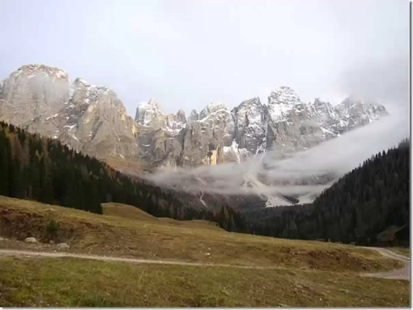
The enchanting Val Canali, situated in the south-eastern part of the Park, to the north is dominated by the imposing rocky groups of the southern slope of the Pale di San Martino, destinations that have always been sought after by mountaineers: Cima Canali (2900m), Sasso delle Lede (2580m) and Cima d'Ostio (2405m) between Val Pradidali and Vallon delle Lede, as well as Cima dei Lastei (2846m) between Vallon delle Lede and Val Canali. These are the mountains that divide, in a rocky triangle, Val Pradidali from Val Canali, characterised at the top by steep steps of glacial origin.
The junction of Val Pradidali with Val Canali is at Cant del Gal, whose name refers to the crowing arenas of the capercaillie. Here there is a large parking area and refreshment facilities.
Paneveggio Forest
.The green slopes framing the Travignolo valley are evidence of this phase of geological history: they are wooded and rich in vegetation typical of soils originating from the disintegration of magmatic rocks. The great Paneveggio forest extends entirely on soils of this type.
.The Pale di San Martino
.For a long time the region of the Pale di San Martino represented - as we have seen - a border zone between emerged land and a shallow sea characterised by emerged islands, subject to erosion, and by areas of shallow water where rock fragments and organic remains were deposited: here, during the Anisian period (between 240 and 236 million years ago) layers of reddish sandstone and grey limestone were deposited, alternating at times with Richthofen conglomerate deposits. In some areas where the marine environment was quieter, far from the outlets of rivers or streams that clouded the water, life-rich environments gave rise to the organogenic sediments of the Serla Dolomite. A typical example of such deposits can be found in the Castelaz.
It was only in a later period (the Ladinic, between 235 and 230 million years ago) that the Dolomia dello Sciliar cliffs were formed, which make up the massive body of the Pale di San Martino. Slightly different is the Dolomia della Rosetta, which formed later in a closed lagoon basin, stratifying on the peak of the same name and on the Pale plateau. That was a time of rapid subsidence, with the Anisian platform breaking into blocks as it tilted south and eastwards, sinking into the sea.
The western area (Pale di San Martino, Marmolada, Latemar, Catinaccio) remained close to the surface of the water, while the eastern side (corresponding to Cadore, Comelico, Zoldano) sank into deep water. Algae and corals rapidly accumulated in well-oxygenated, clean and calm waters. As the subsidence continued, new coral colonies overlapped the remains of the pre-existing ones until they reached a thickness of about 800 metres. The result was a clear, compact, crystalline dolomite, without stratifications: older than the other types of dolomite that characterise the eastern sector of the Dolomites and the Brenta Group.
The dolomitisation process (resulting from the double exchange of calcium and magnesium between the rock and the sea water) did not have the same intensity everywhere; so much so that, in the vicinity, mountains such as the Marmolada, Costabella and Latemar have maintained their original limestone composition.
The porphyries of the Lagorai and Cima Bocche
The Lagorai chain and the Cima Bocche massif are made up of quartziferous porphyries, bearing the mark of the Quaternary glaciations, the most evident aspect of which is the presence of the high altitude lakes, which filled the erosion basins of the ancient glaciers.
The Lagorai chain and the massif of Cima Bocche are the last offshoots of a great expanse of mountains carved into the volcanic bench of the 'Atesine porphyry platform'.
The rocks that constitute it - and which we call quartziferous porphyries with an imprecise but widespread term - are the result of a series of eruptions that around 270 million years ago, in the Permian geological period, from volcanoes located in the Bolzano area covered the entire region up to Cima d'Asta with successive waves of lavas and burning clouds.
The ash and incandescent debris brought by these produced the rhyolitic ignimbrites, used today for the preparation of "porphyry cubes" (an active quarry is located at the entrance to the Park, near the Lago di Forte Buso).