Punta del Tuf, from the Valnontey car park

Edited by:
Giancarlo Beretta
Updated at: 07/06/2026
Access
Road navigation
At the motorway junction of Aosta West, enter the roundabout and take the second exit following the signs for / Cogne / Aymavilles. Continue on for 20.0km (20.0km) to the roundabout at the entrance to Cogne, where take the first exit onto Avenue G.F. Cavagnet (350m, 20.35km). Continue on Via Bourgeois (120m, 20.5km), then turn right onto Rue Grand Paradis. Follow Rue Grand Paradis for 2.4km (22.9km), continue on Frazione Valnontey for 210m (23.1km) and turn right to reach the car park.
Parking
At the end of the road is the 🅿️ car park in Valnontey, the access point to the Gran Paradiso National Park. Check on site for access conditions and any seasonal restrictions imposed by the park authority.
Access by public transport
The Valnontey car park can be reached by the Cogne urban circular line run by SVAP. The reference stop is Cogne Valnontey. The winter service runs every weekday and on public holidays, except 25 December and the summer period; the runs serving the Valnontey stop depart from Cogne Revettaz at 09:00, 10:05, 11:10, 12:40 and 15:00, arriving in Valnontey at 09:25, 10:30, 11:35, 13:05 and 15:25 respectively. For updated timetables please consult the timetable SVAP - Cogne Urban Line.
Distance and travel time
🕒Travel time: 35 minutes
📏 Distance: 23.5km
GPS navigation
Information note
The information provided has been verified as of the date of the survey of the itinerary. Before departure, it is recommended to check possible changes in the route or road conditions. Please consult Google Maps or Apple Maps for the latest information.
.Introduction
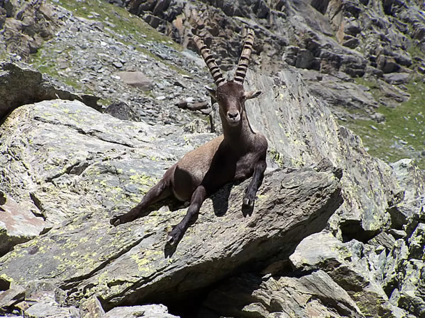
A long and tiring itinerary, but rewarded by splendid high-mountain environments and, especially in the upper part of the itinerary, animal sightings: we are in the middle of the Gran Paradiso National Park and encounters with its guests are frequent. For the past few years, the middle section of the old path to the Sella refuge has been closed due to the danger of landslides, and a section of the route that is usually taken in the ski mountaineering season has been well maintained as an uphill variant.
Description
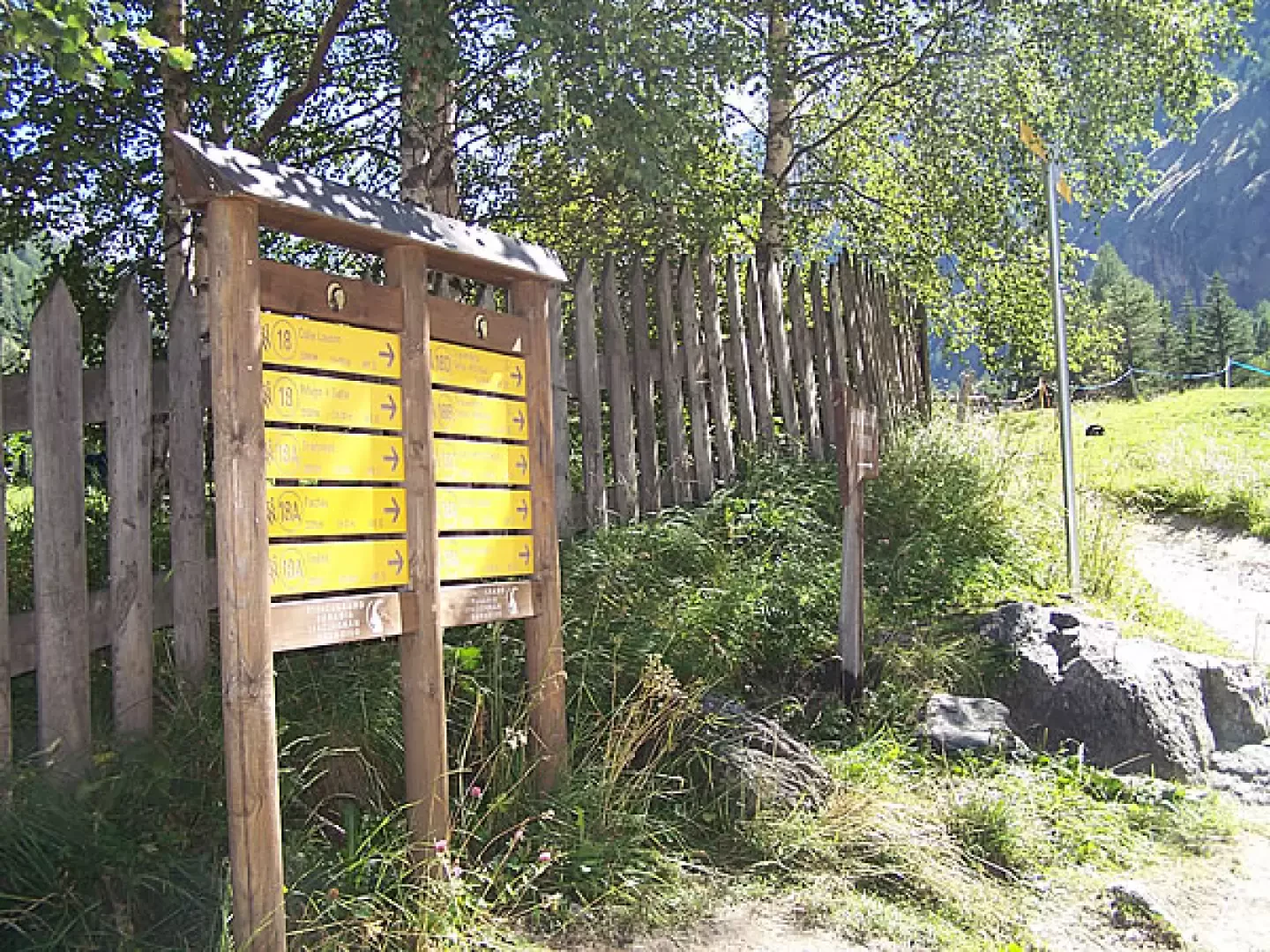
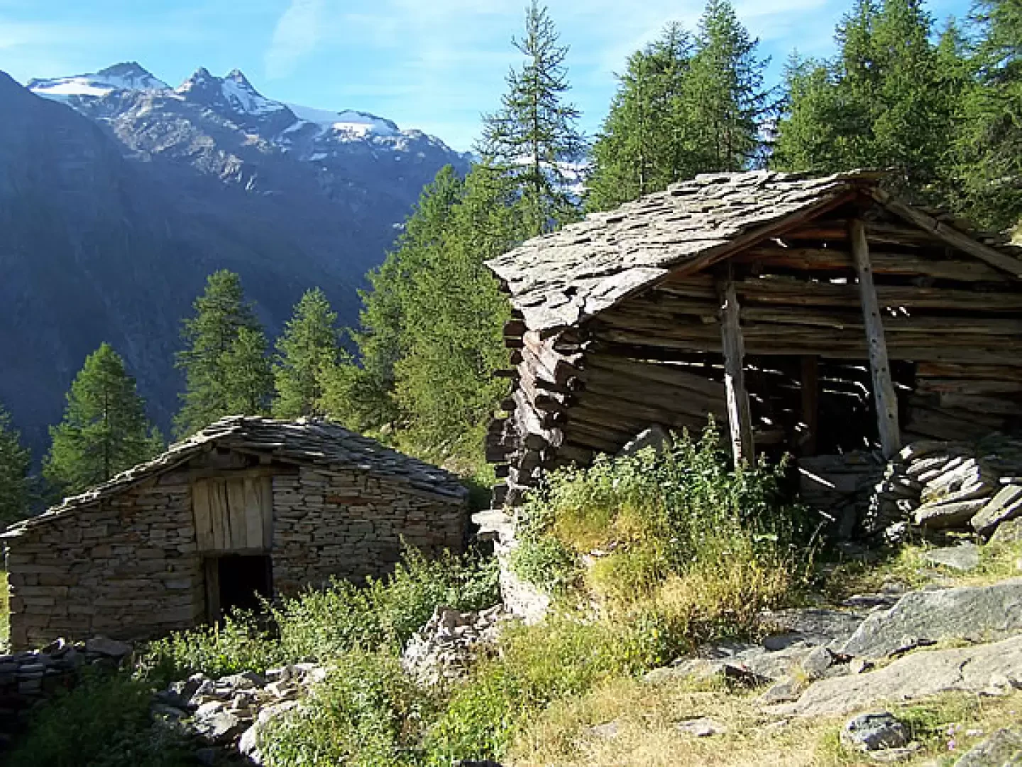
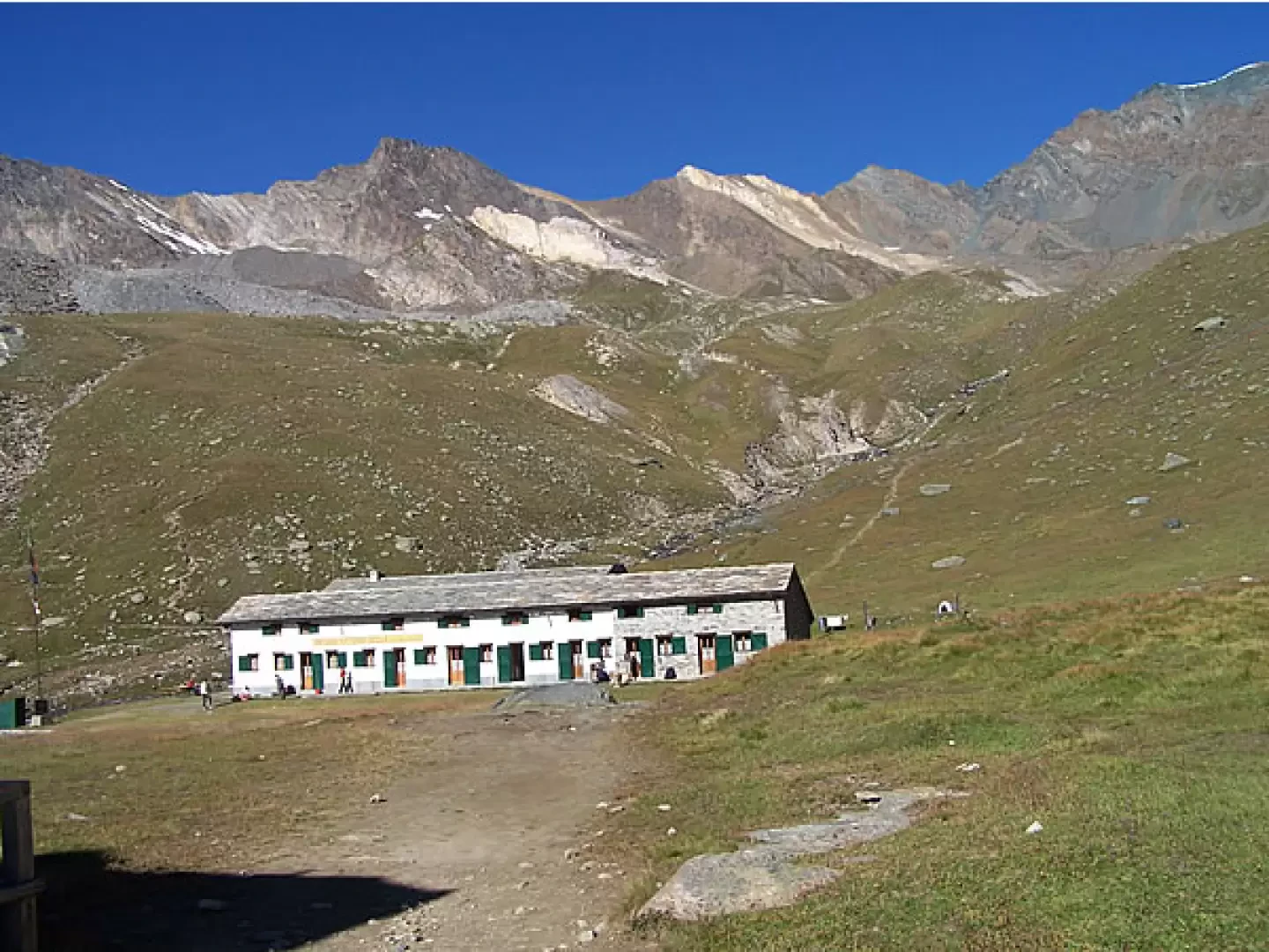
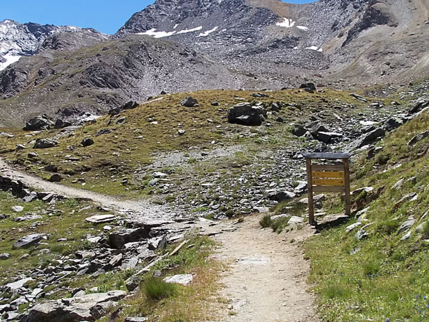
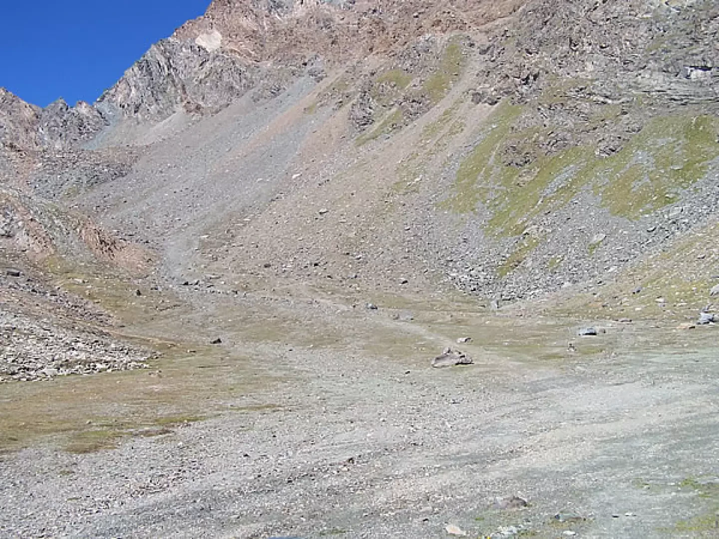
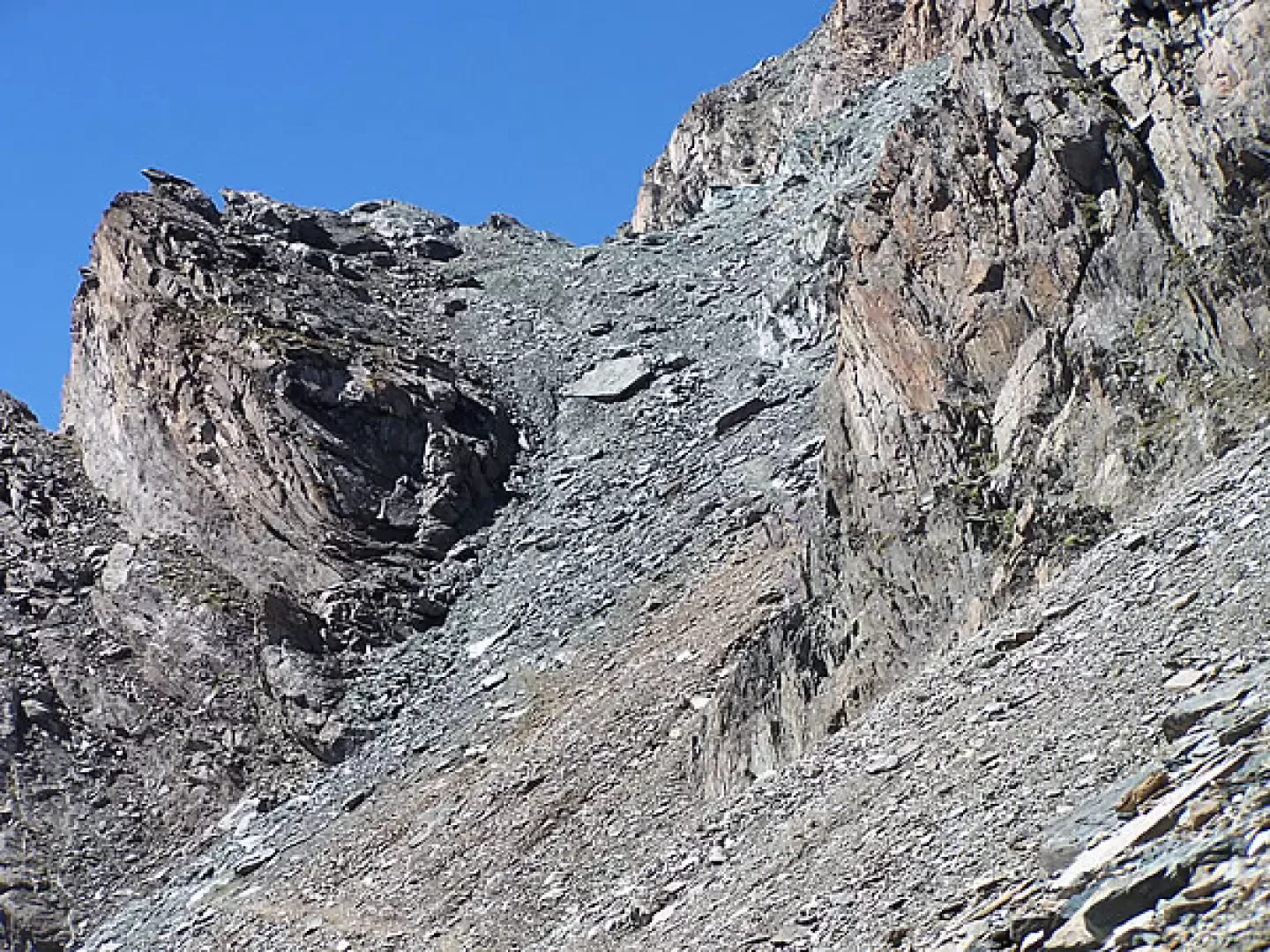
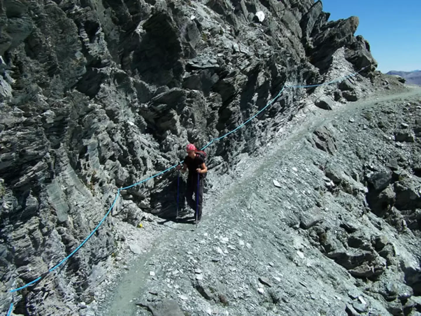
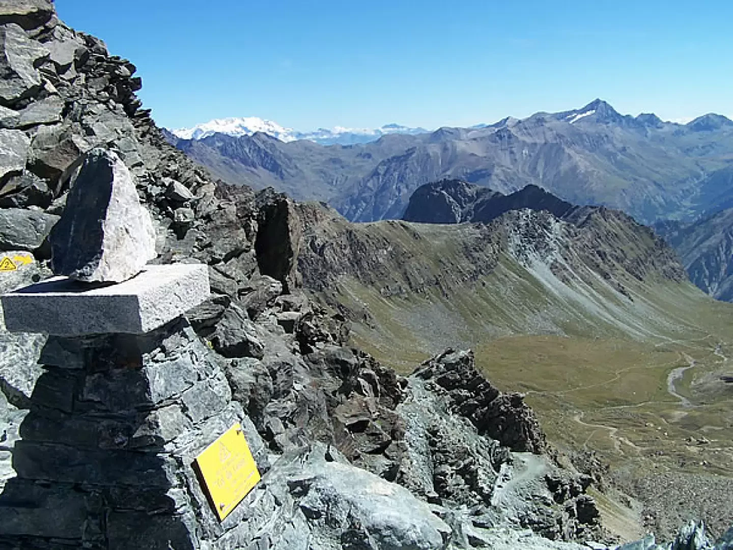
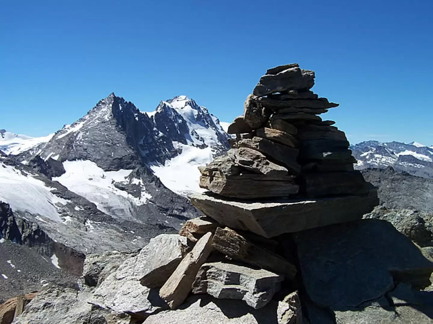
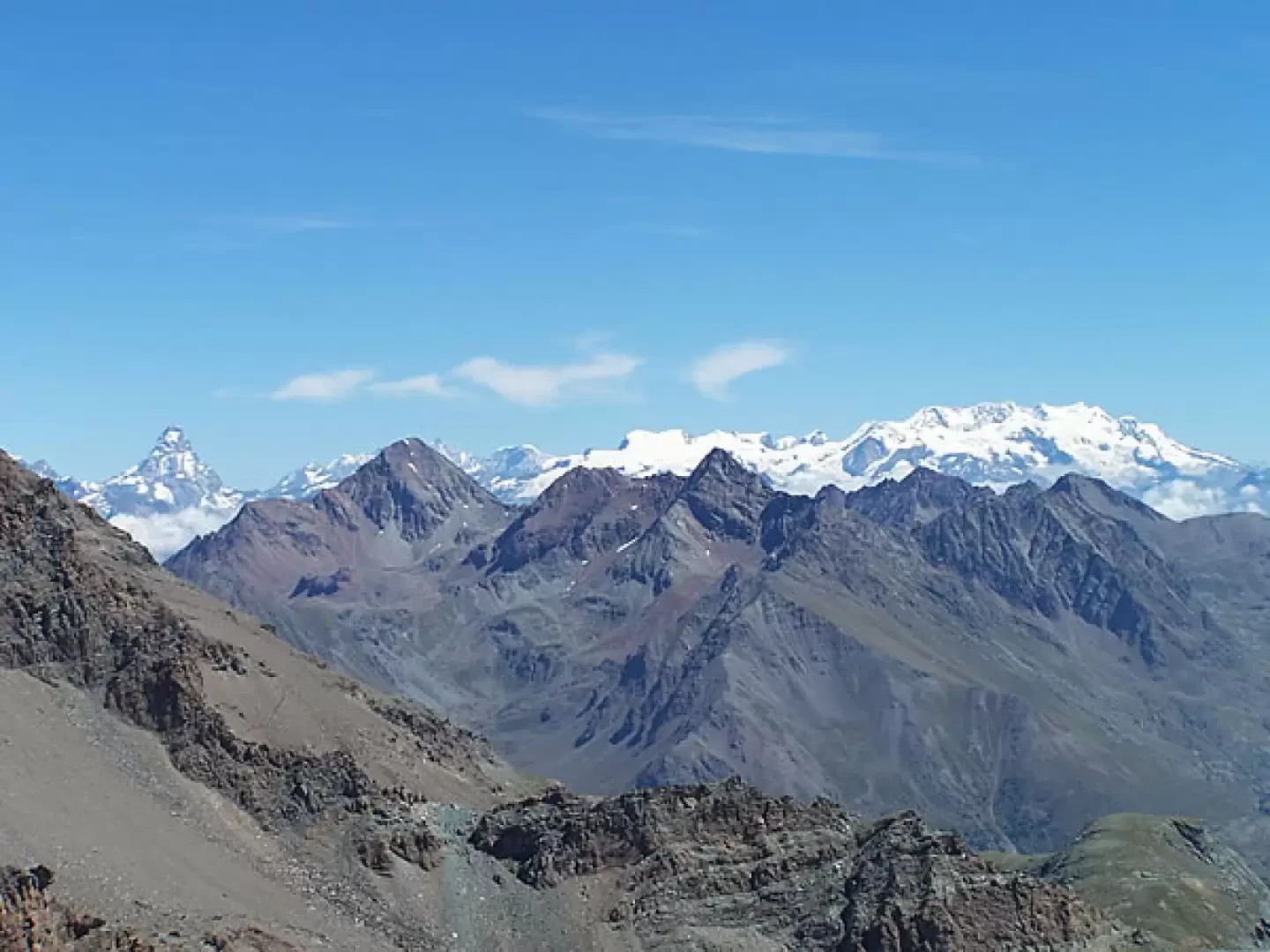
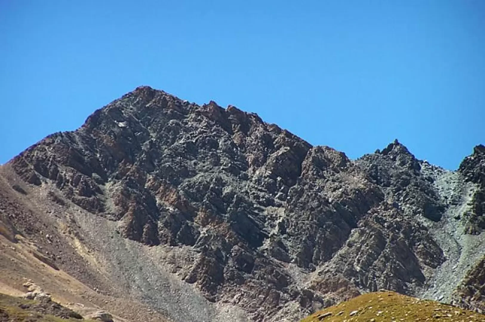
Leaving the car in the Valnontey forecourt, cross the bridge over the stream of the same name and follow the wide mule track that runs alongside the Giardino Alpino "Paradisia" shortly afterwards entering a larch forest. After about 300 metres of difference in altitude, i.e. having reached the point where the mule track approaches the Grand Lauson stream, you will find a sign on the right preventing you from proceeding along the old path; you then descend a few metres to the left to cross a small bridge and thus reach the opposite bank. The ascent now becomes a little steeper and climbs, without many hairpin bends, over stretches of terrain graded with small logs alternating with stretches with outcropping stones to reach the Pacheu pastureland (2222 m). We pass among the old huts and, after about ten minutes, the path bends slightly to the right, then descends a few metres to reach another small bridge that takes us, climbing up a couple of hairpin bends, back onto the old track that at first halfway up the slope and then with increasingly narrower hairpin bends takes us to the altitude of the Grand Lauson alpine pasture (2506 m) located on the opposite side of the valley. The slope now softens and in a few minutes we come in sight of the old royal hunting lodge, now used as a park ranger's hut, from where, a little further on, we can see the Vittorio Sella hut. Near the hut, follow the path (signposts) that climbs at a moderate slope diagonally across the grassy slopes to reach the head of the valley and thus gain a plateau. Continuing on the false plain, you cross the stream that descends from the Rossa valley and, climbing for about ten minutes on undulating grassy terrain, you reach a crossroads at an altitude of 2,844 m, from which you must take the path to the left and then, after crossing a stream and going along a wide diagonal and a subsequent hairpin bend, you reach a vast hollow with a sandy bottom, perhaps followed with a watchful eye by some of the inhabitants of the area. Cross it to the west, continuing to climb at first on gently sloping terrain in the centre of the basin, then the track moves to the right on a steep scree slope. The trail rises with many twists and turns, approaching the base of the rocky crags of the Becca di Vermianaz (3406 m), below which it crosses a steep, rocky slope in narrow serpentines until it reaches a small ledge from where the Lauson pass is clearly visible: the "EE" section begins from the beginning of the ascent to the ledge. From this point, walk along the little path, in some places very narrow and a little exposed, skirting the rock face with ledges supported by small iron girders and a short section equipped with a rope, and you will reach the bottom of the short and steep, but still clearly marked, gully of scree that culminates at Col Lauson 3296 m. From the little pillar of the col, head westwards on the track, made of loam and a few unstable stones, which avoids a sharp rocky outcrop to the right; having reached a small saddle, the shaky track continues to turn over slightly more unstable and exposed terrain to the right of the ridge line and soon reaches the little man on the summit, consisting of a short rocky ridge. The panorama remains a little closed to the north due to the close and imposing presence of the Grivola, but for the remaining horizon the spectacle is assured from the Matterhorn to Rosa, to the Grand Sertz and from the summit there is above all an unusual view of the northern slopes of Gran Paradiso and Herbetetet. The return is made by following the ascent route.
Galleria fotografica