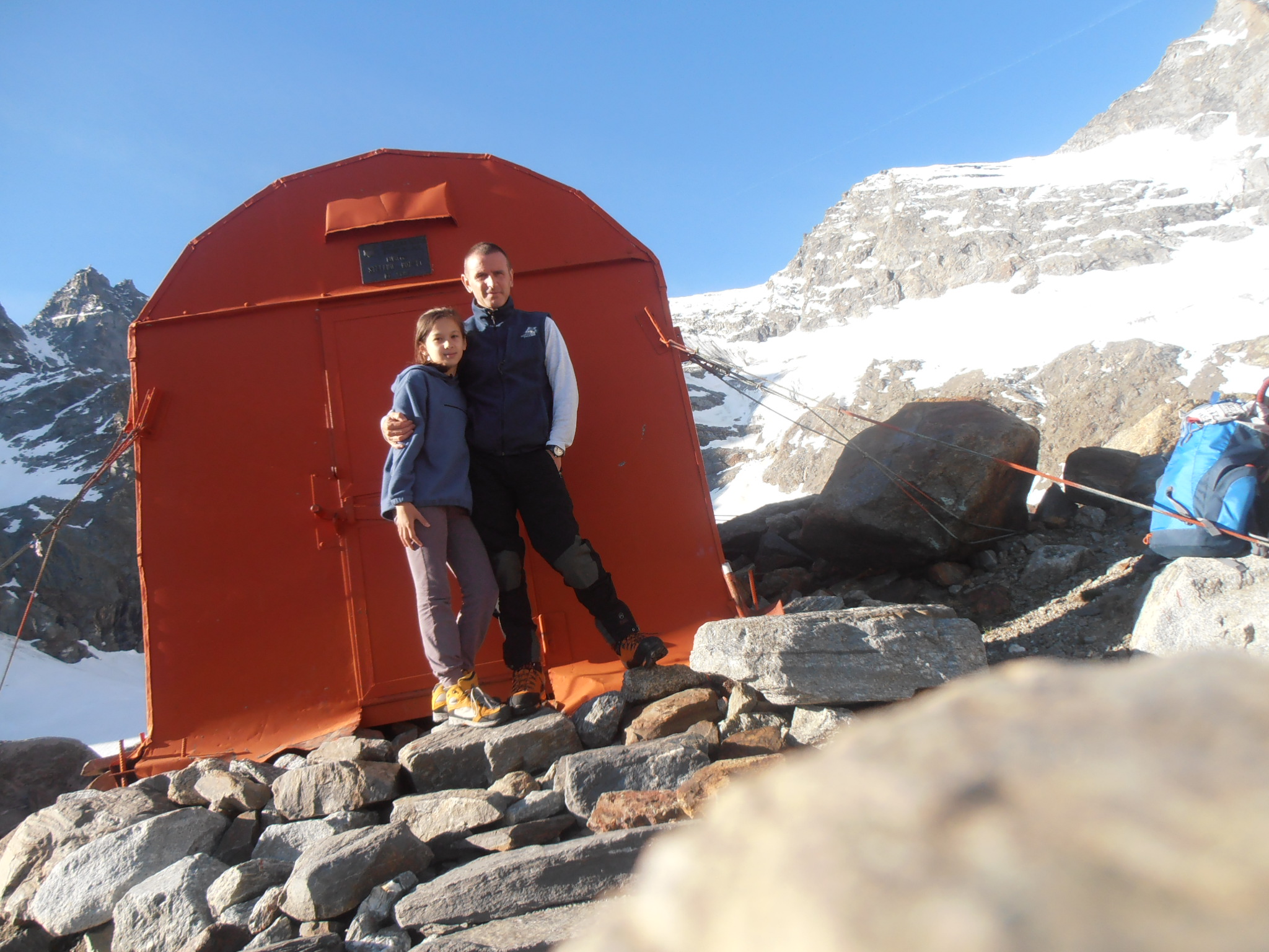
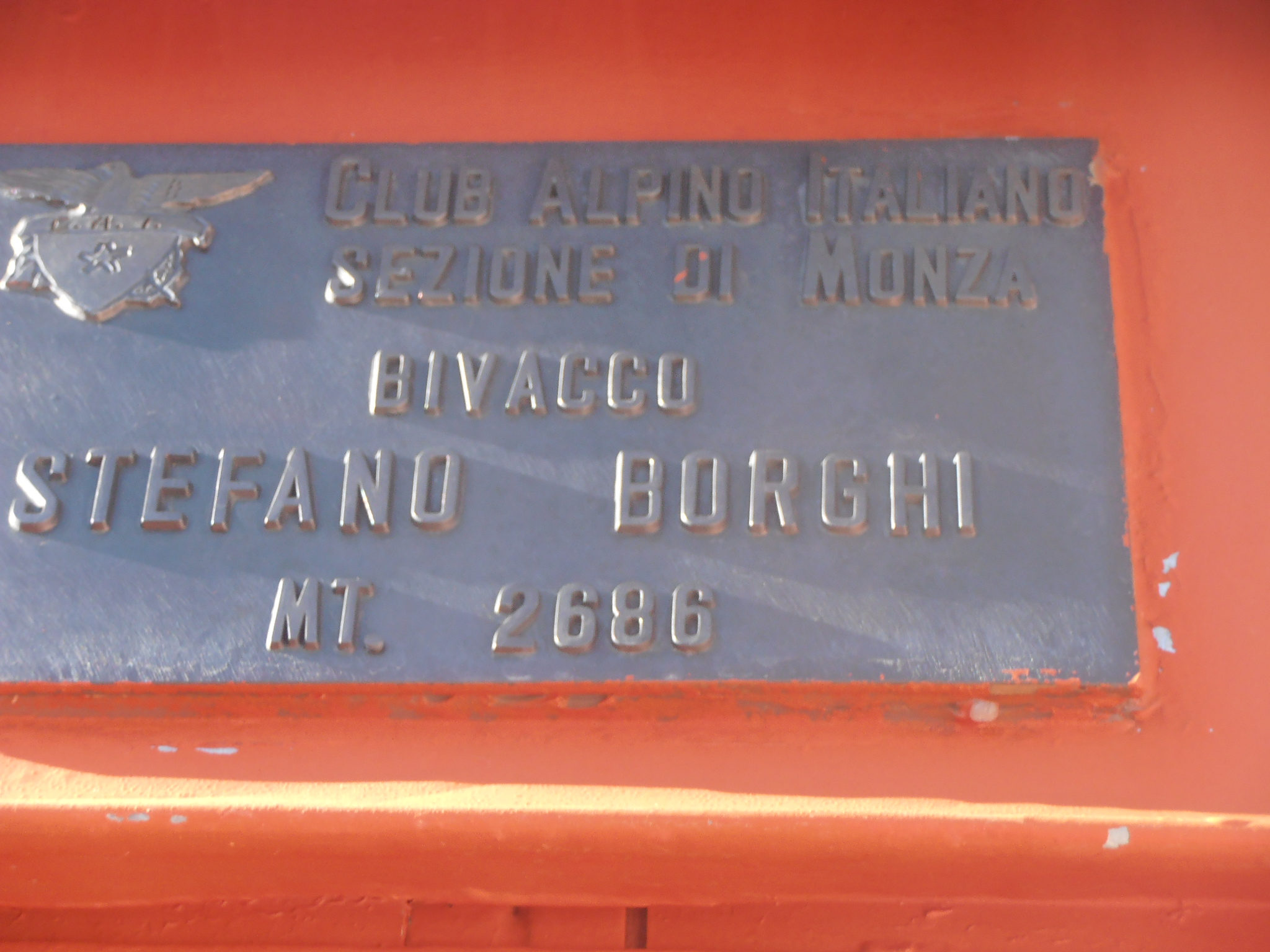
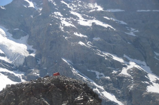
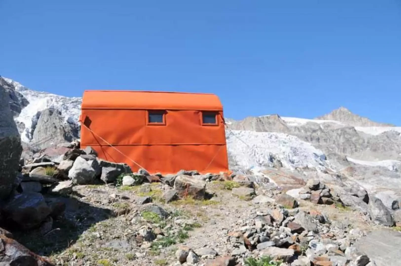
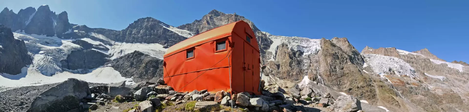
Borghi bivouac, from Valnontey

Edited by:
Giancarlo Beretta
Updated at: 07/04/2026
Access
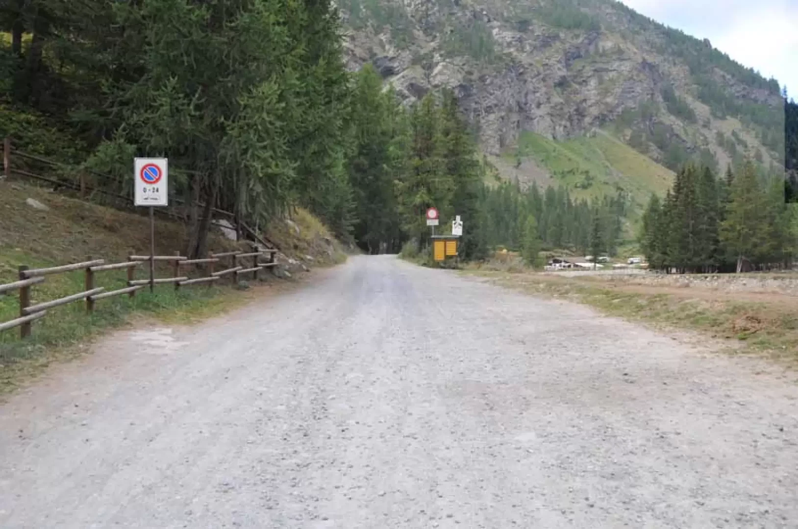
Leave the motorway junction at Aosta-West and turn right to take the Valle di Cogne. Drive through the village of Aymavilles and after 1.50 kilometres at a roundabout take the second exit. Go up the regional road for 18.70 kilometres passing through the villages of Vieyes, Epinel and Crétaz until you reach a roundabout: take the first exit onto Avenue G.F Cavagnet, to be followed for about 350 metres. Inside the village of Cogne, turn right onto the small road that after about 2.70 kilometres reaches the village of Valnontey anticipated by the large car park 🅿️ for a fee (from 8am to 8pm - 4€ full day) located to the right of the road.
Distance and journey time
🕒Travel time: 34 minutes
📏 Distance: 23.40 km
GPS navigation
📍 How to get there with Google Maps
📍 How to get there with Apple Maps
ℹ️ Important note
The information provided was checked on the date of the route survey. Before departure, it is advisable to check for any changes to the route. For up-to-date and detailed directions, we recommend the use of Google Maps or Apple Maps.
Introduction
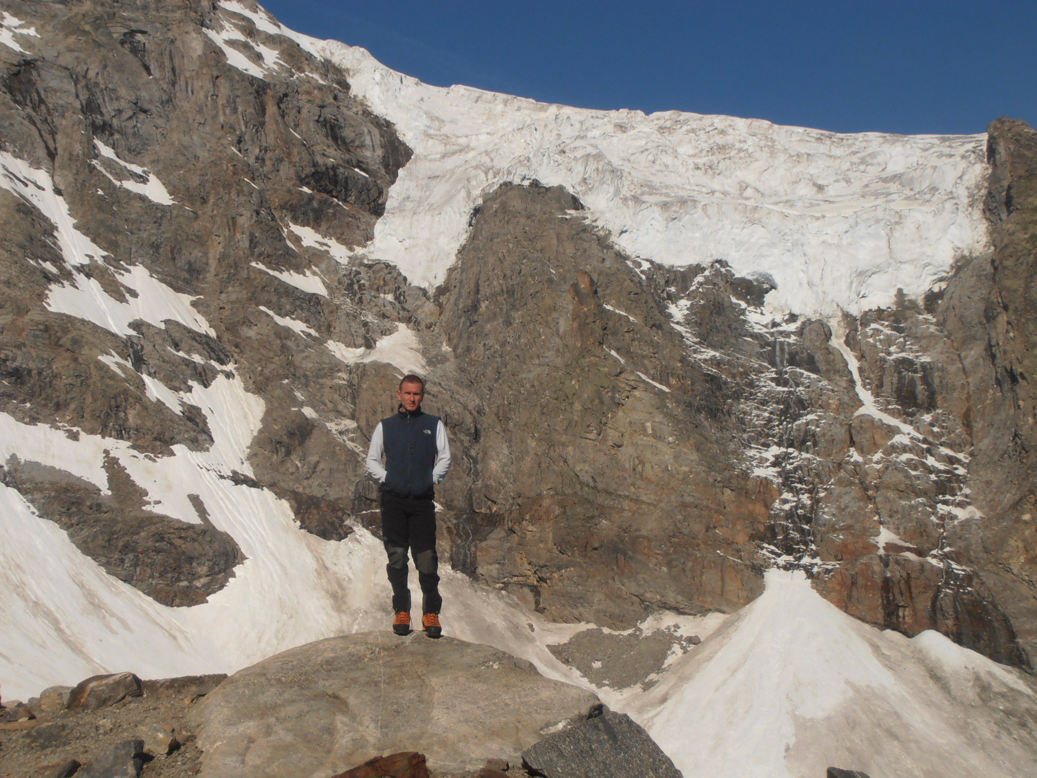
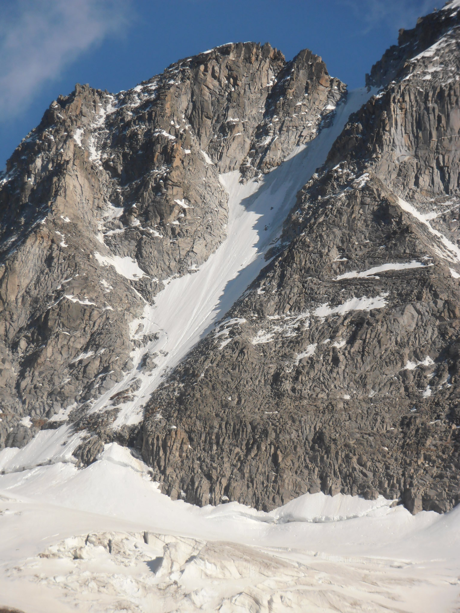
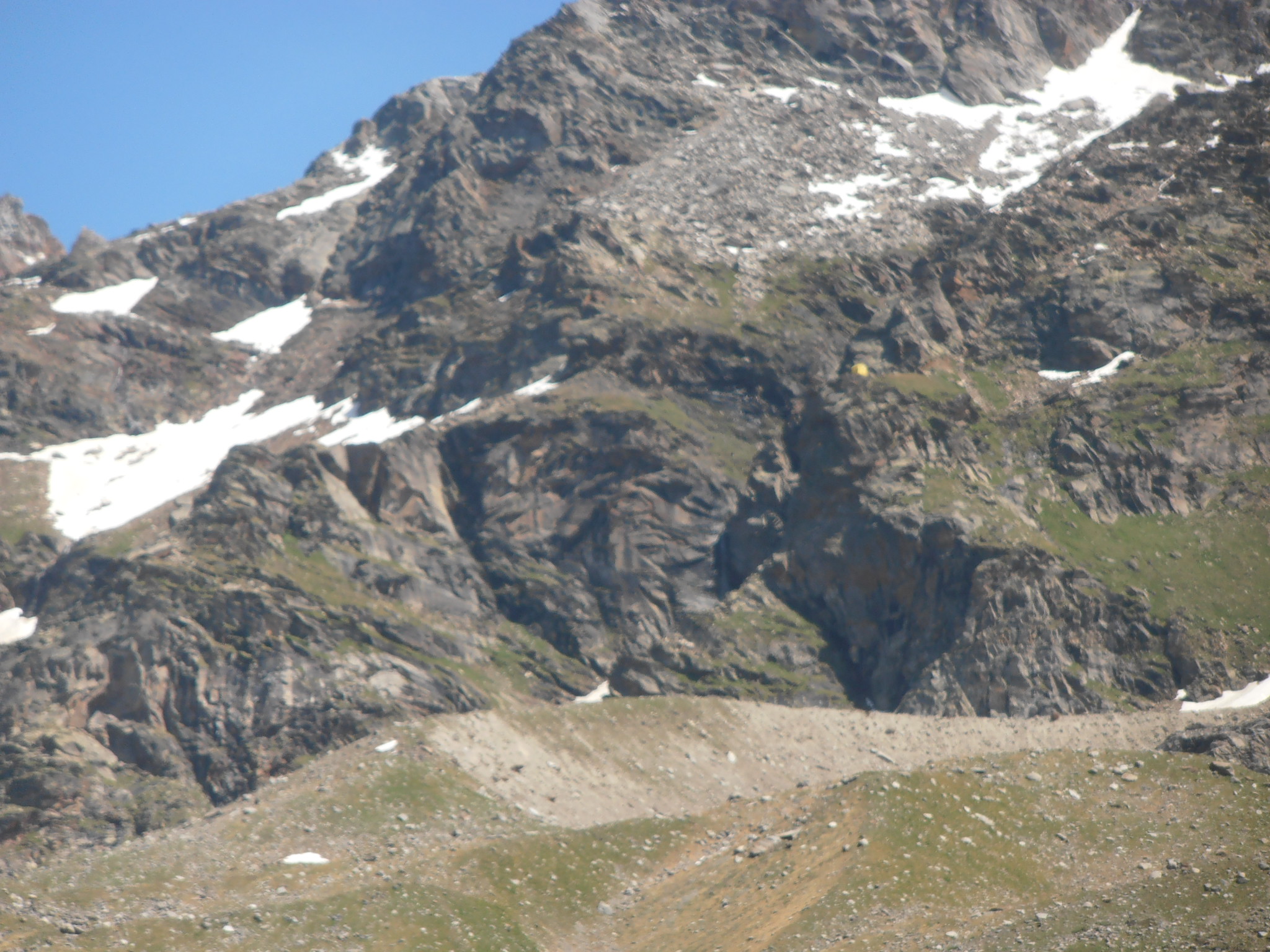
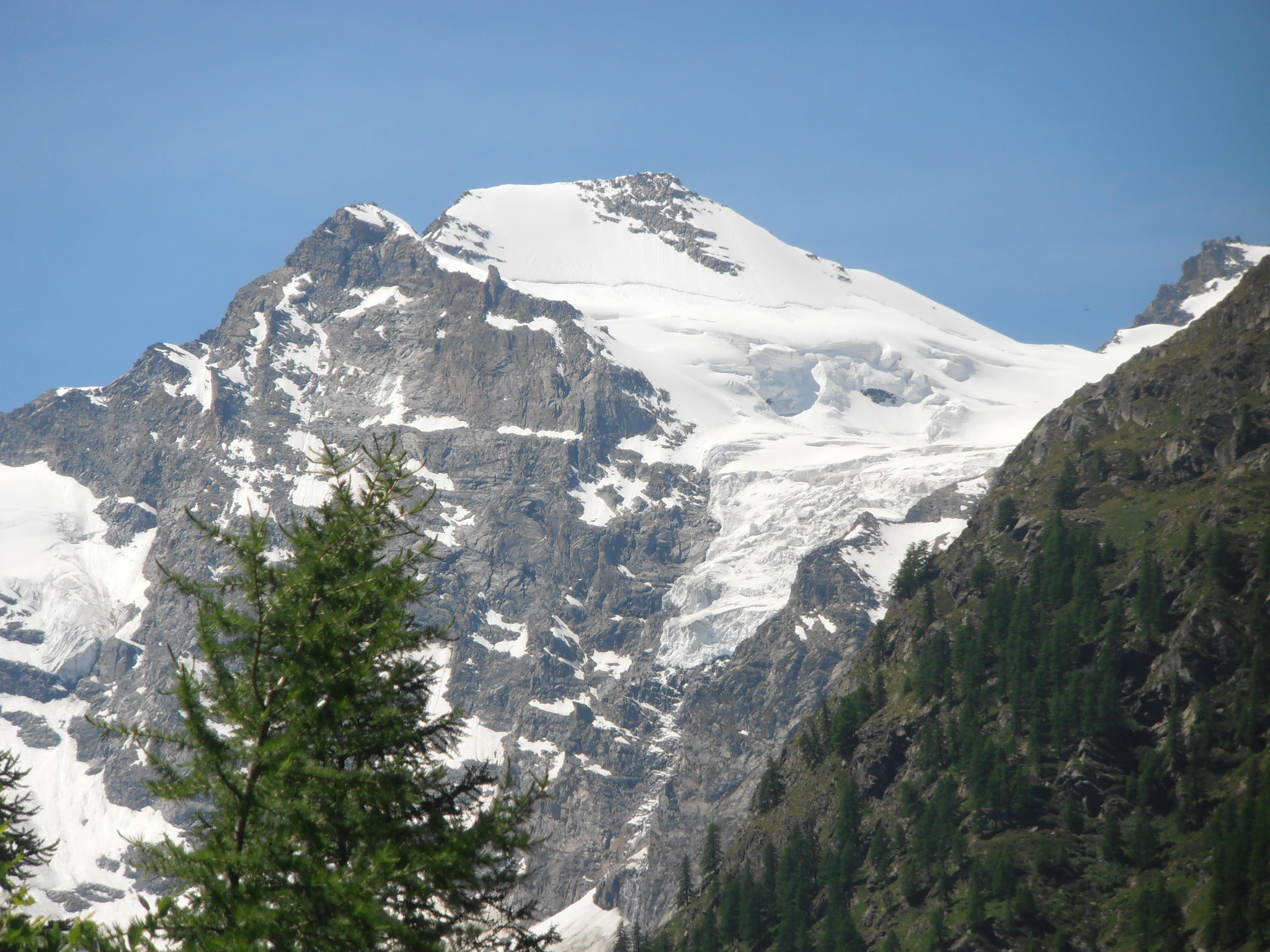
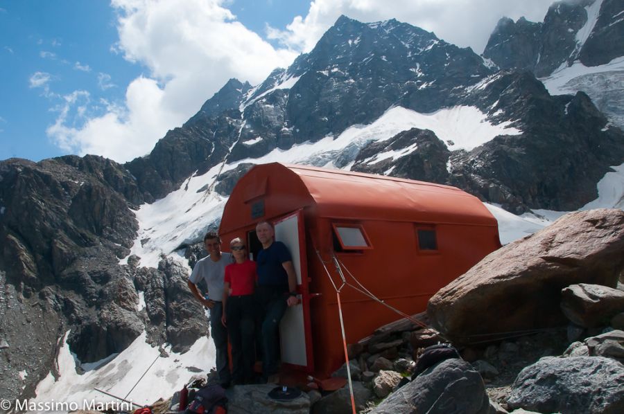
The Borghi bivouac is located above a rocky islet that sits alone at the base of the Gran Crou glacier. The hike is demanding and tiring, especially in the second part after the junction for the Herbetetet cottages, with very steep sections and rocky climbs where, if they are wet, you have to be a little careful. From the bivouac, you cannot see the summit of Gran Paradiso, but the close view of the two seracs of the Tribolazione glacier is spectacular and, continuing to the right, you can see Herbetetet and Grivola, while behind, the Roccia viva, Testa del Grand Crou and Testa della Tribolazione dominate.
Description
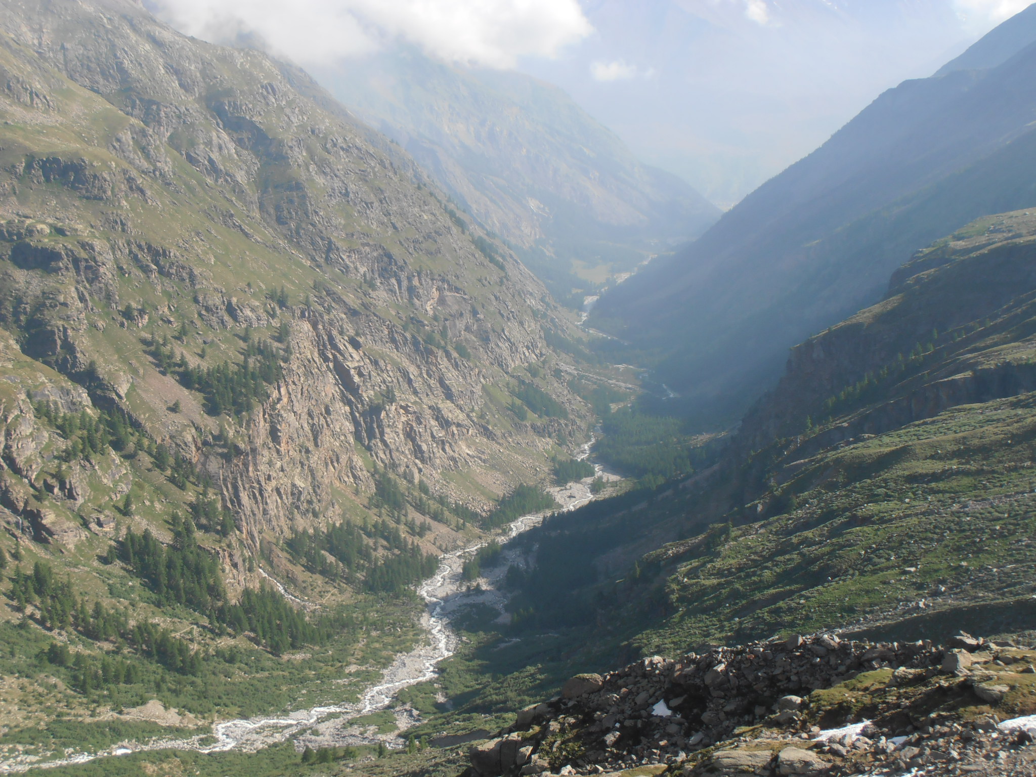
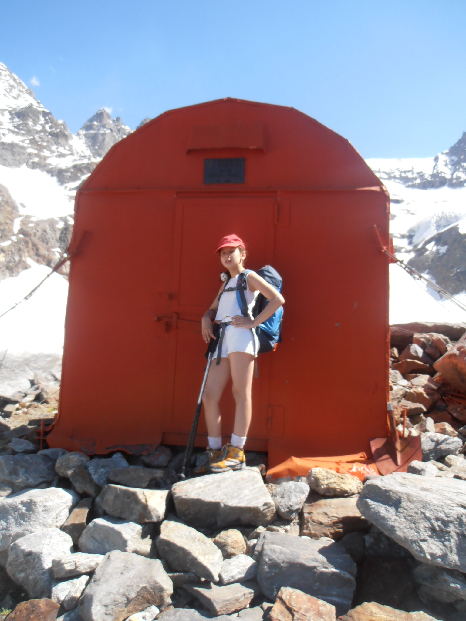
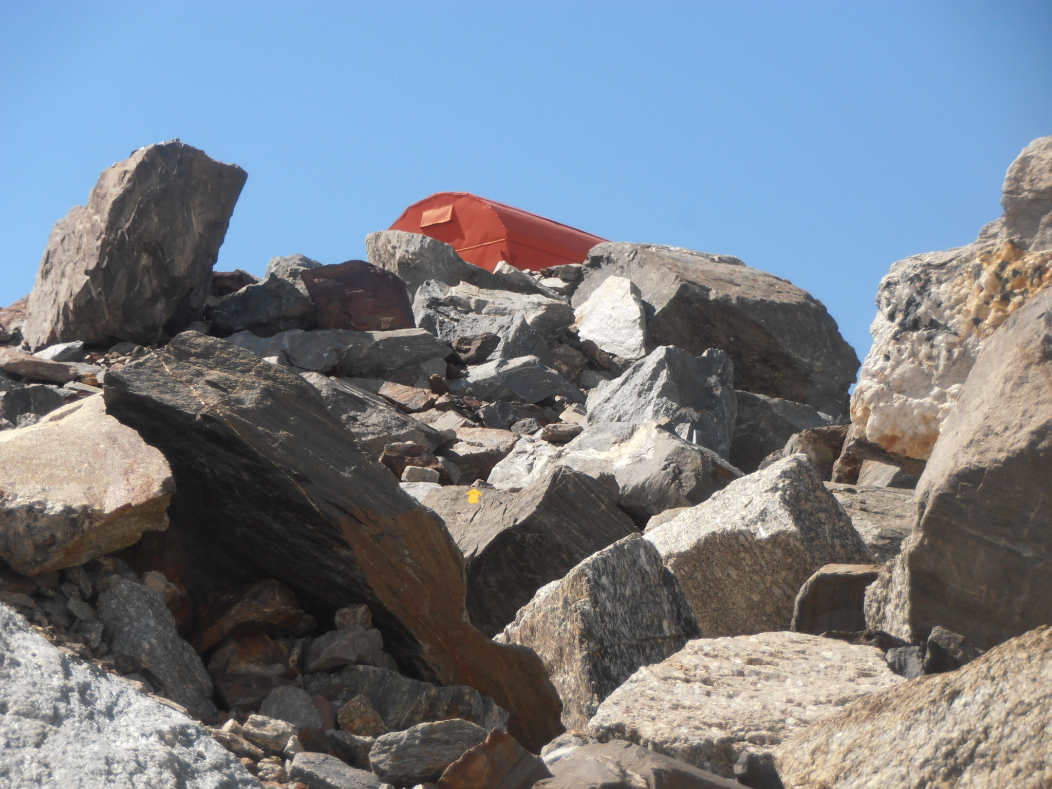
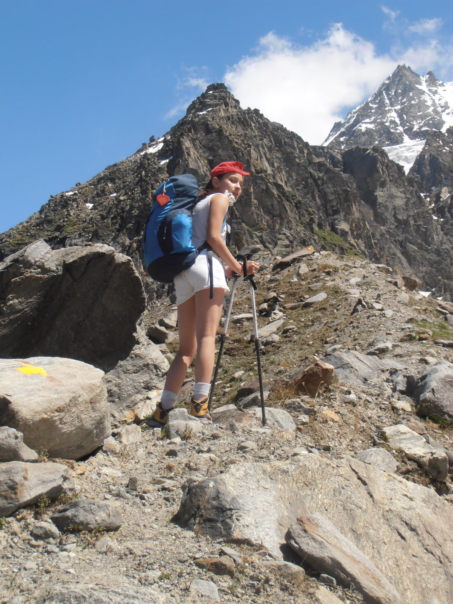
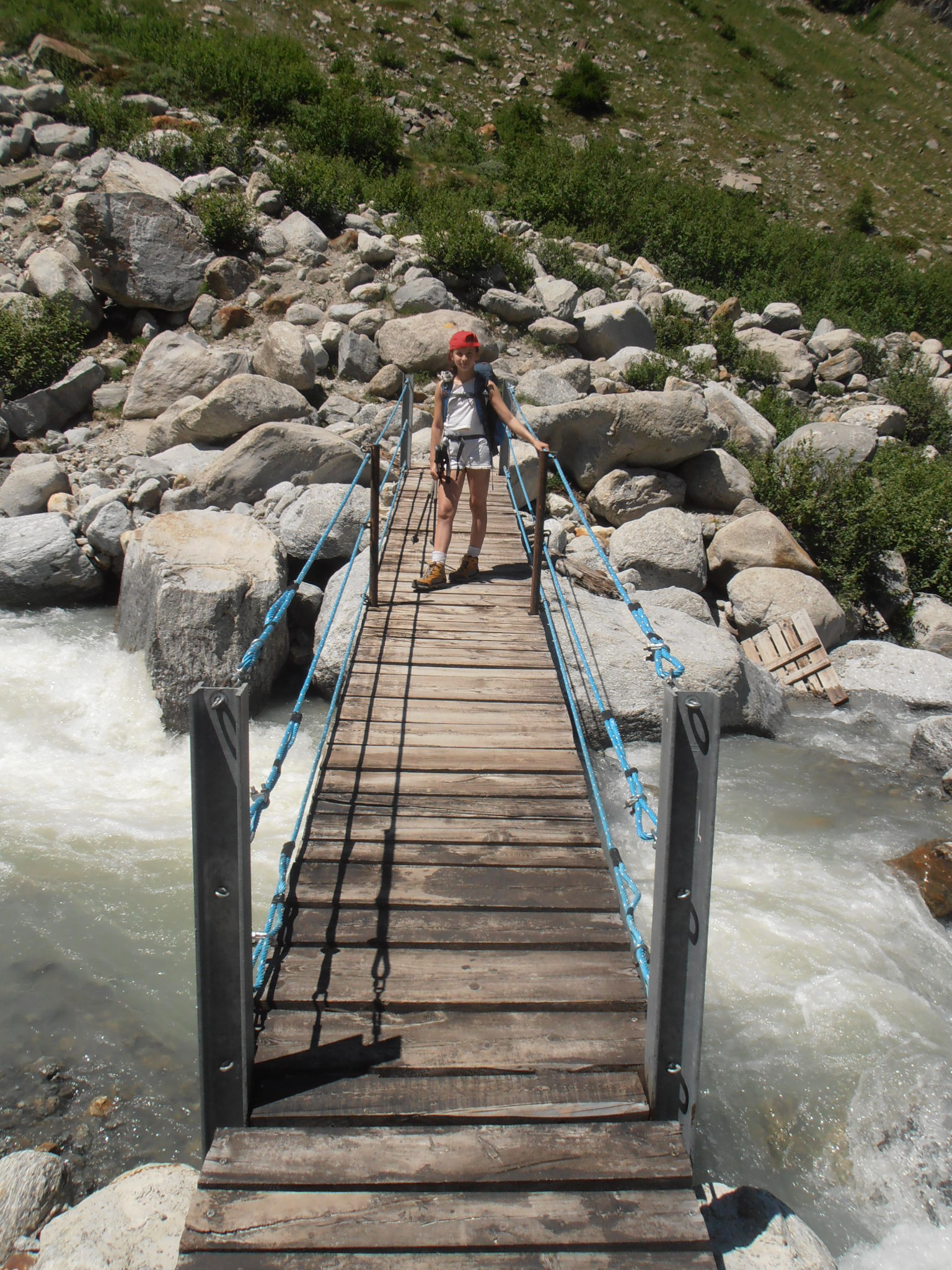
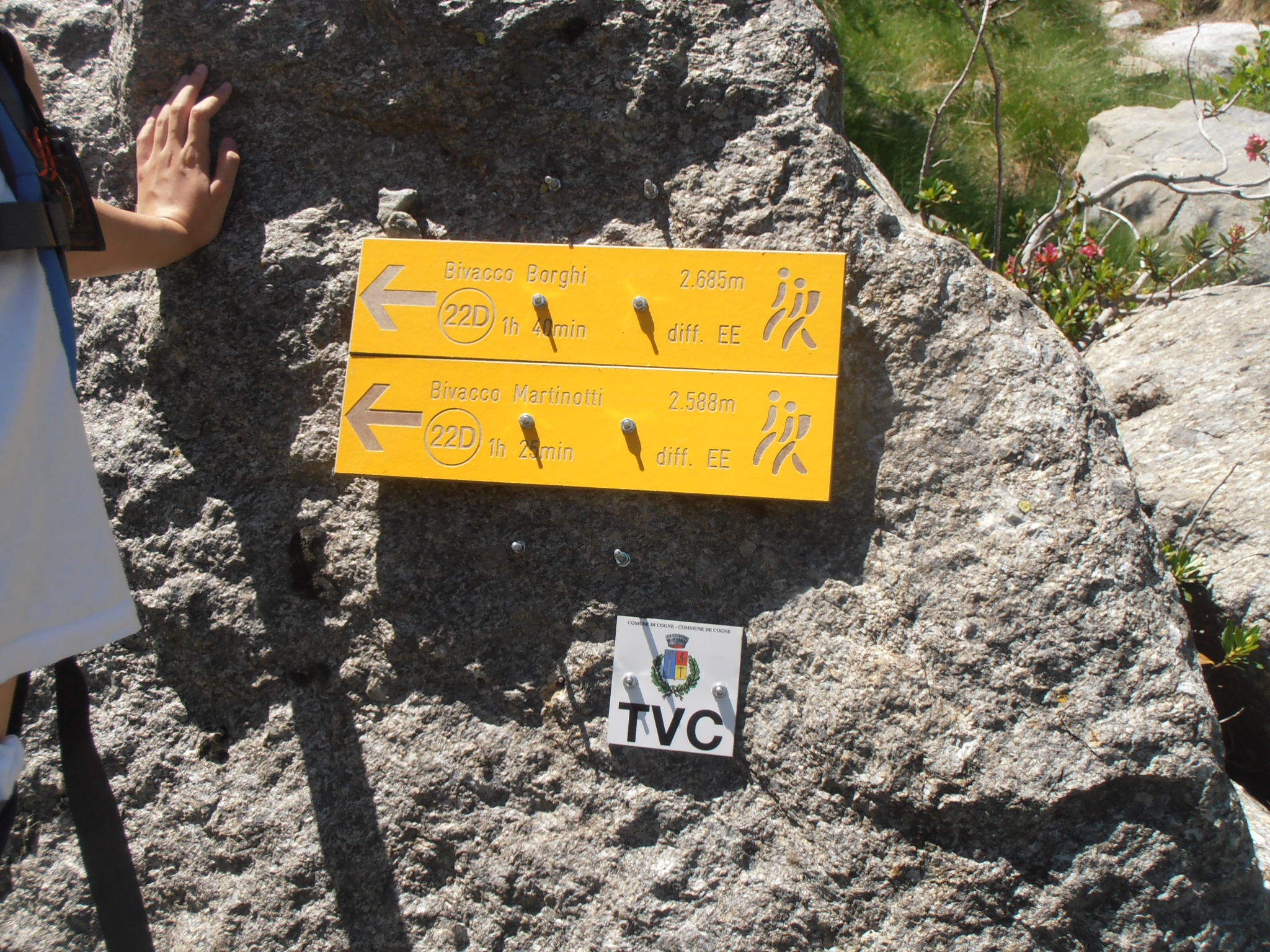
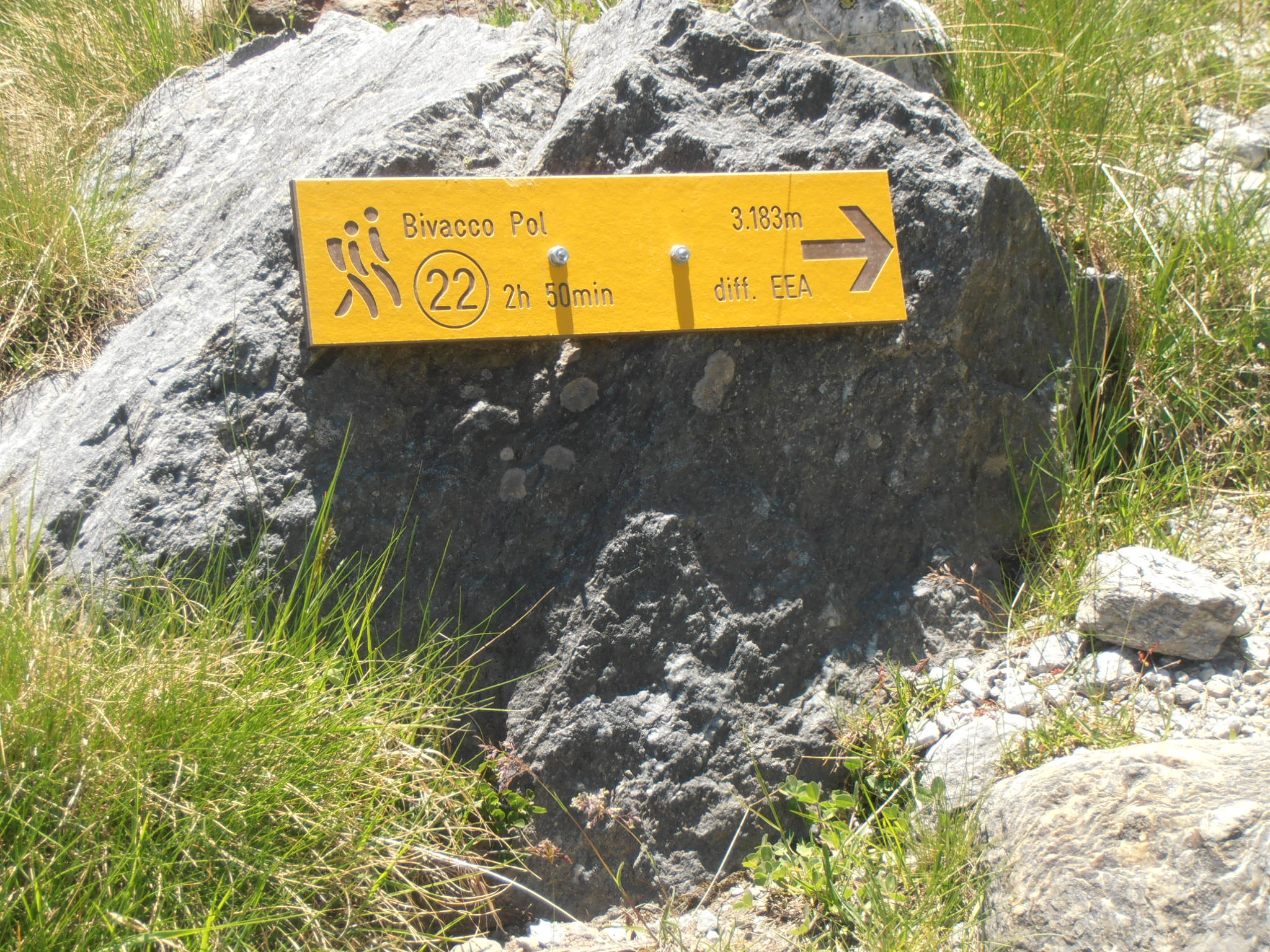
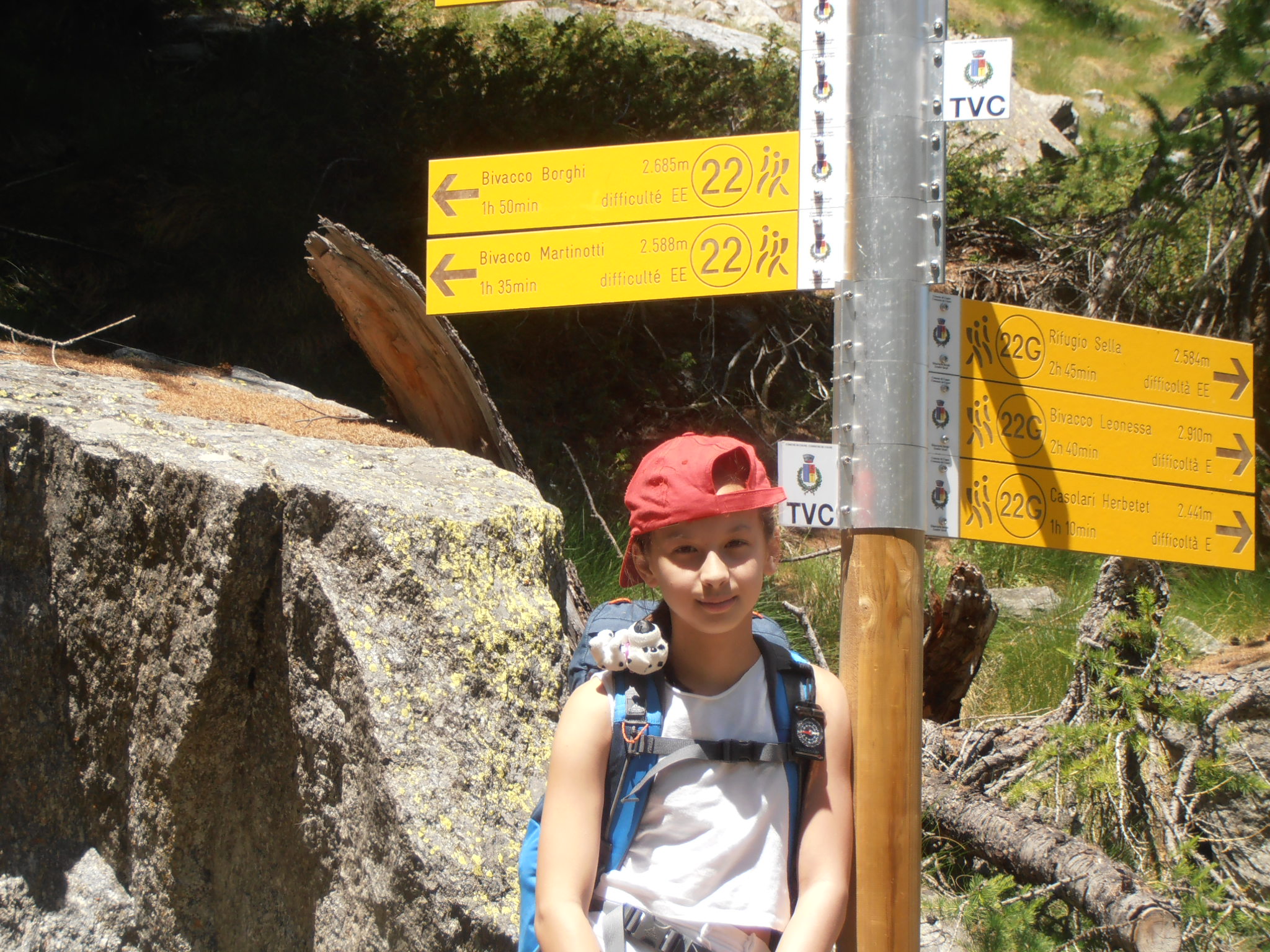
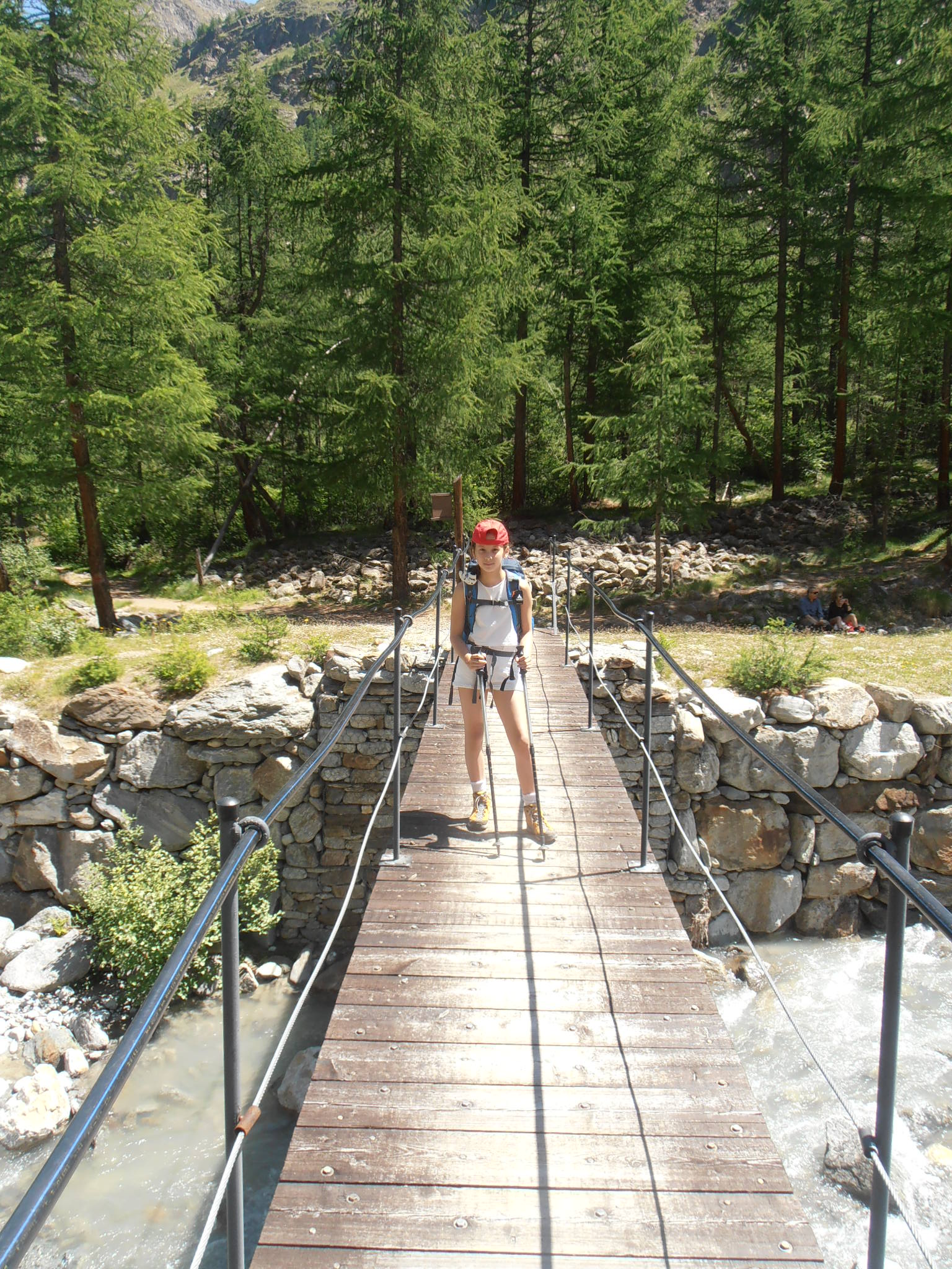
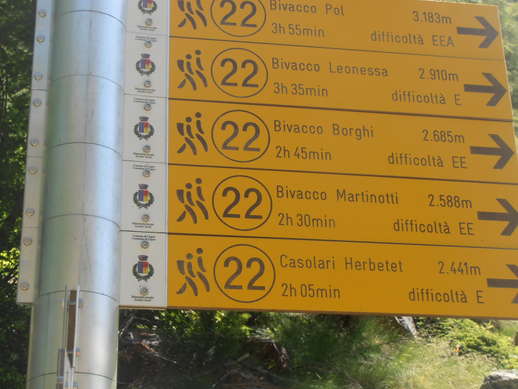
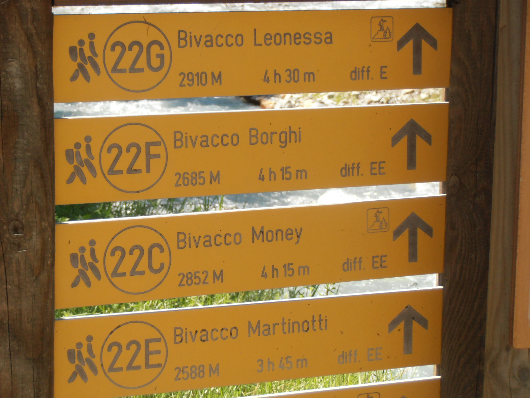
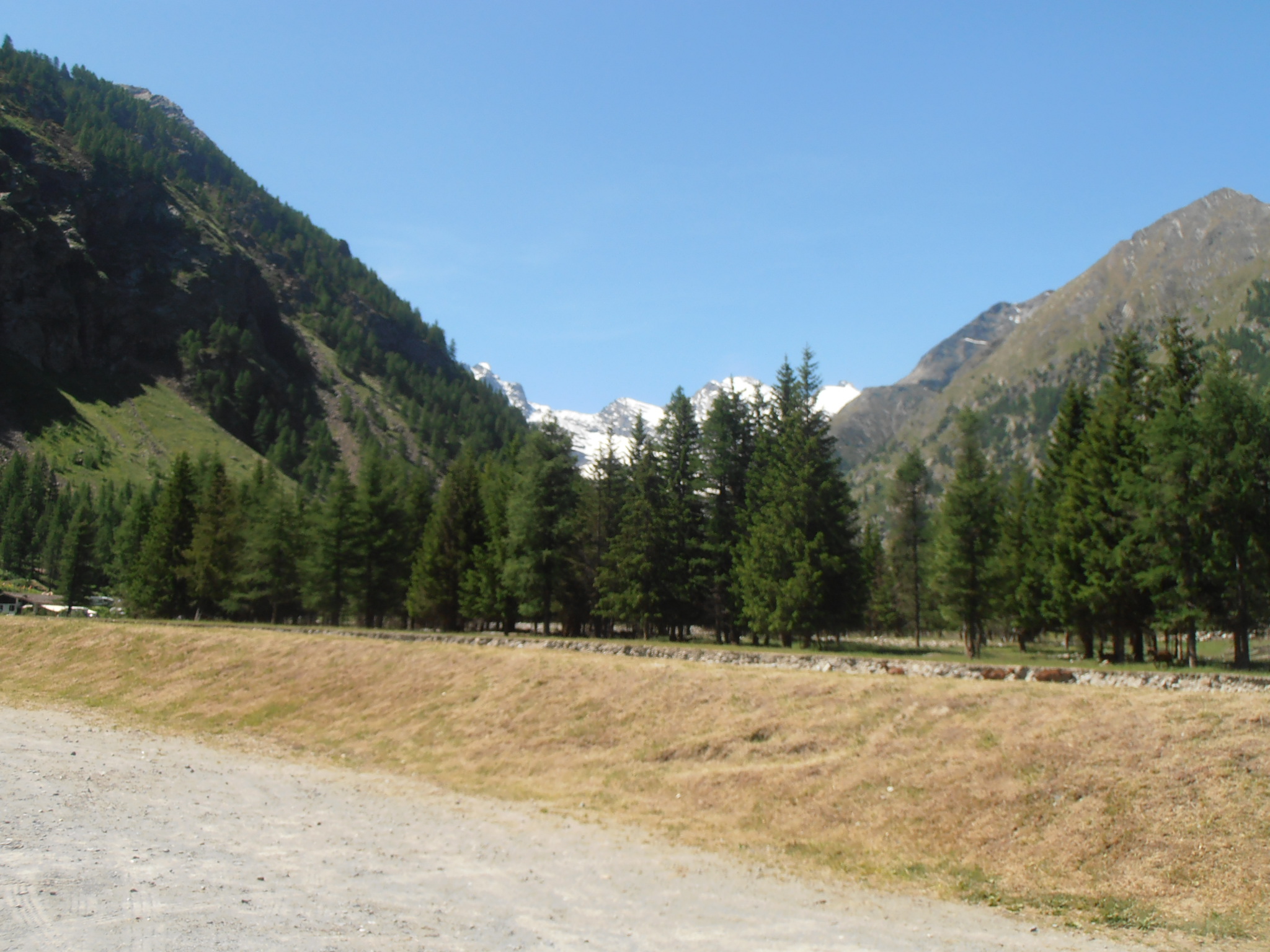
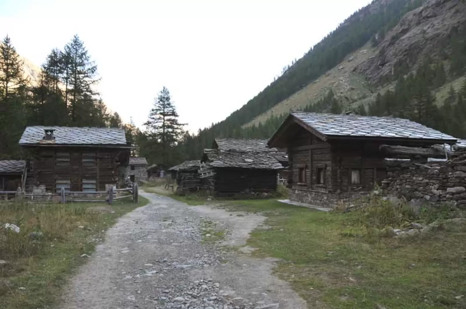
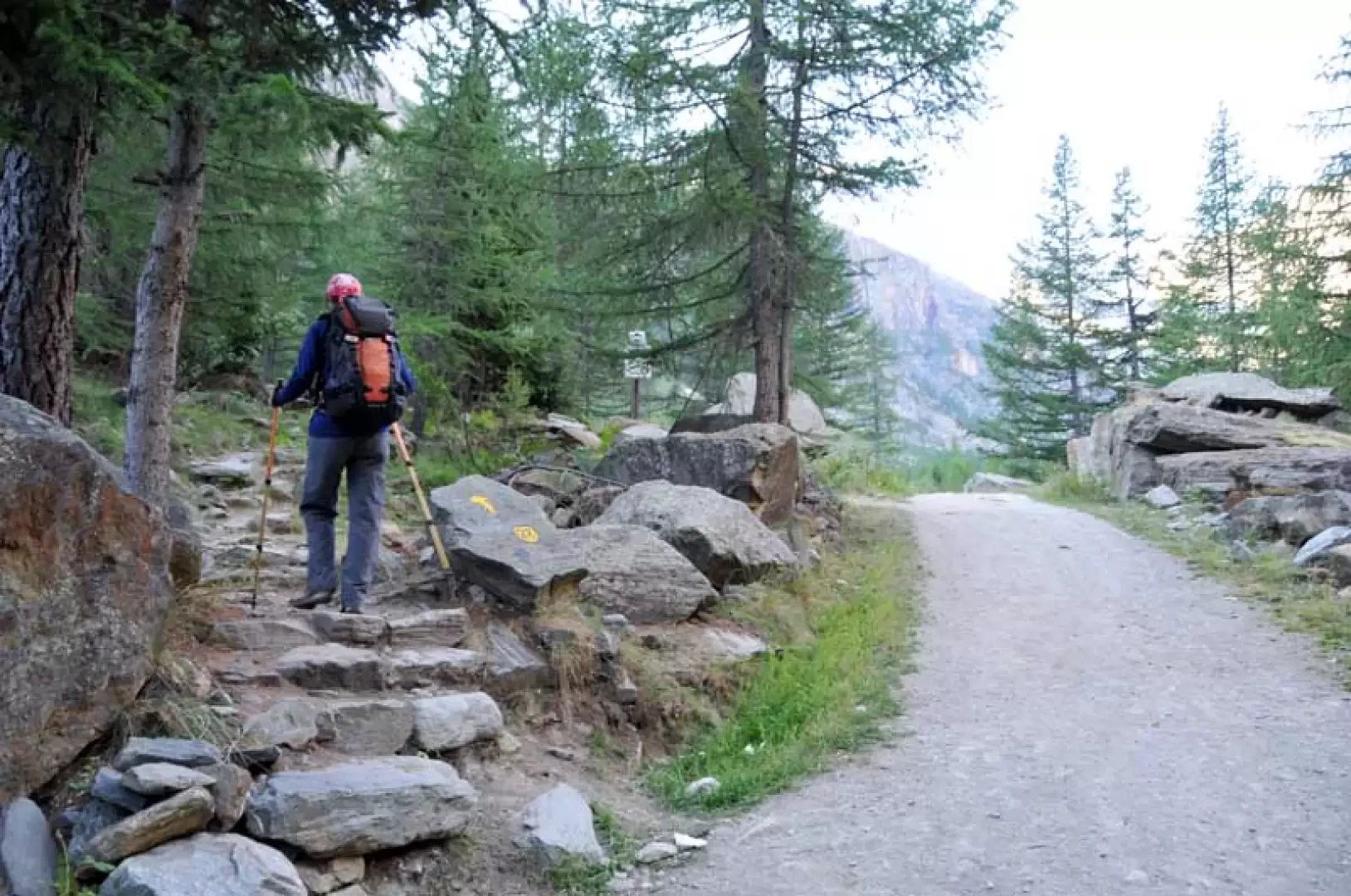
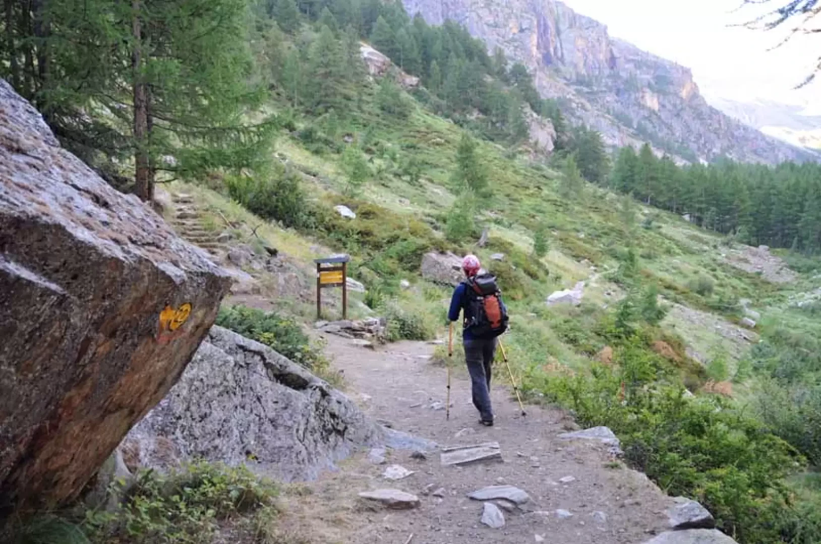
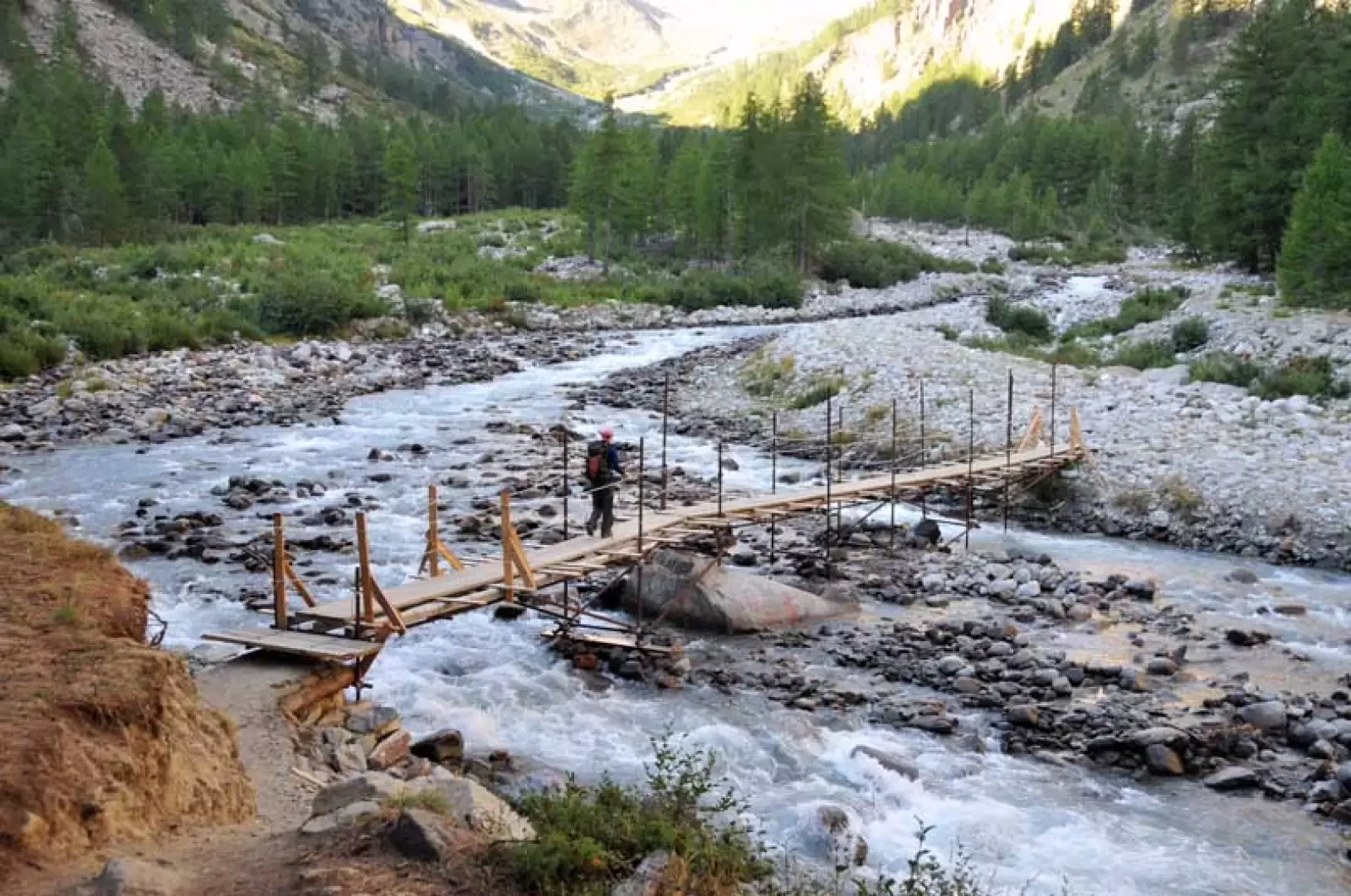
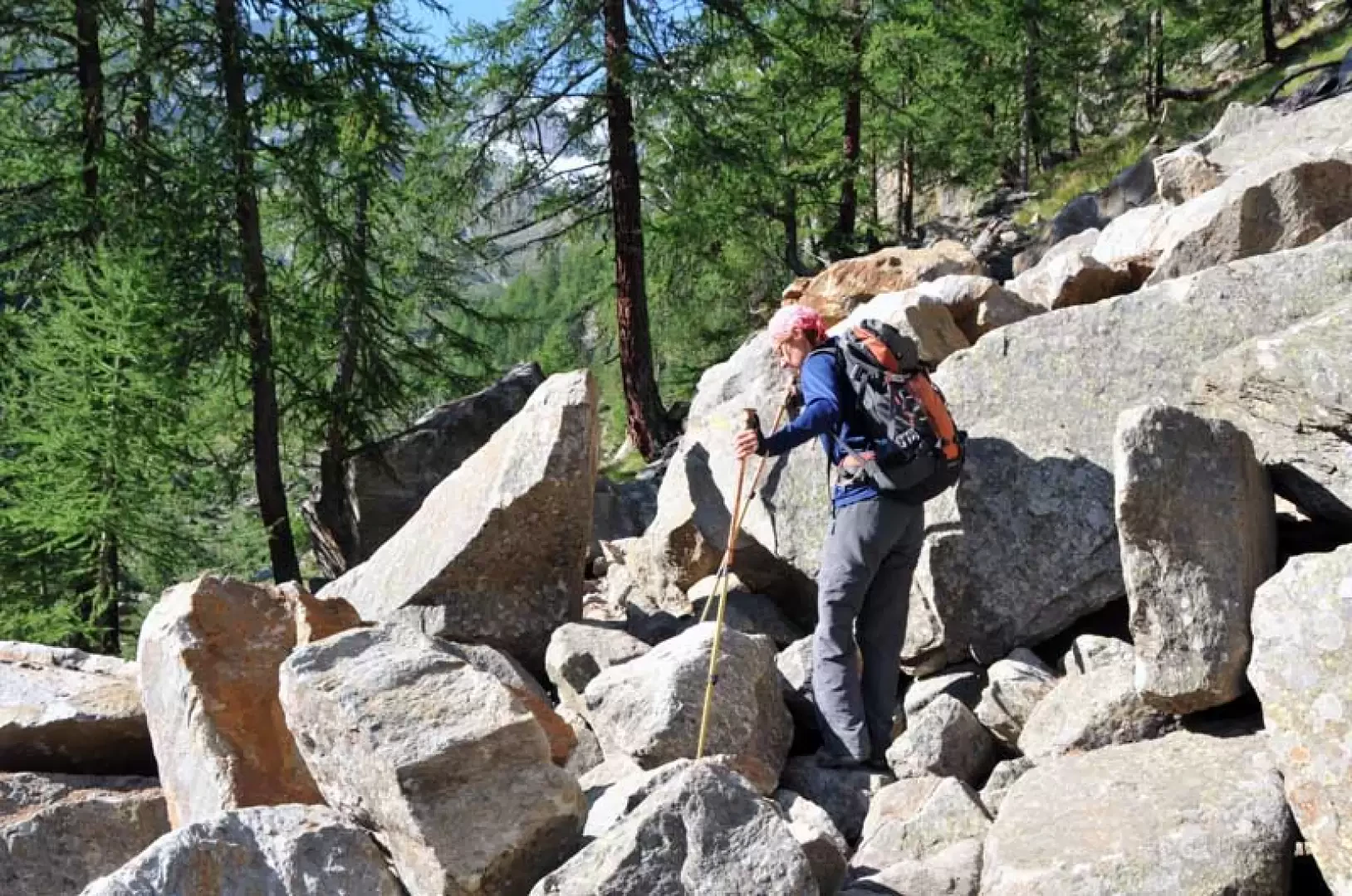
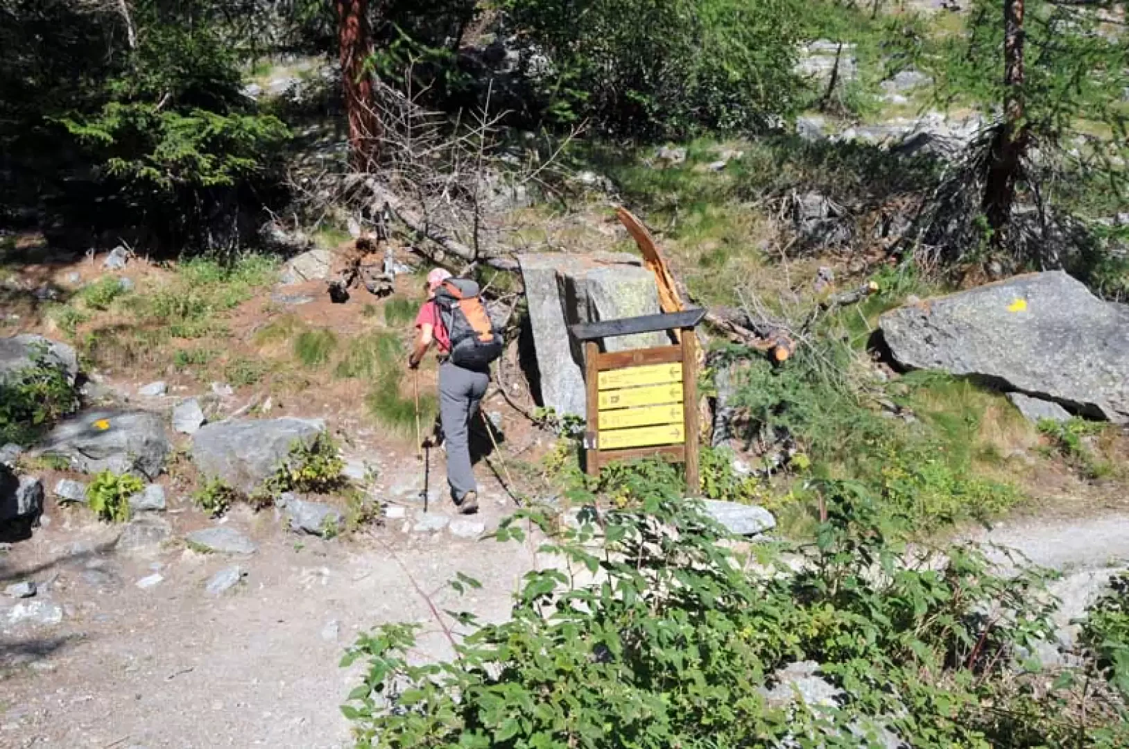
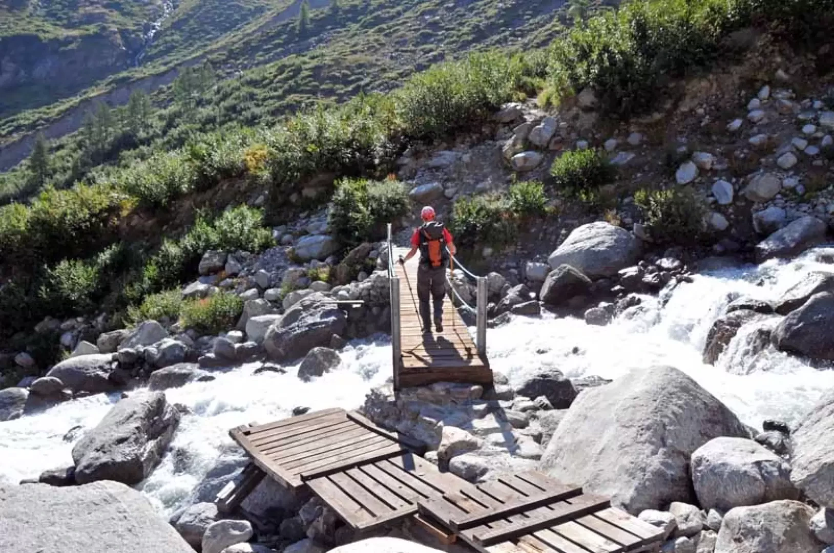
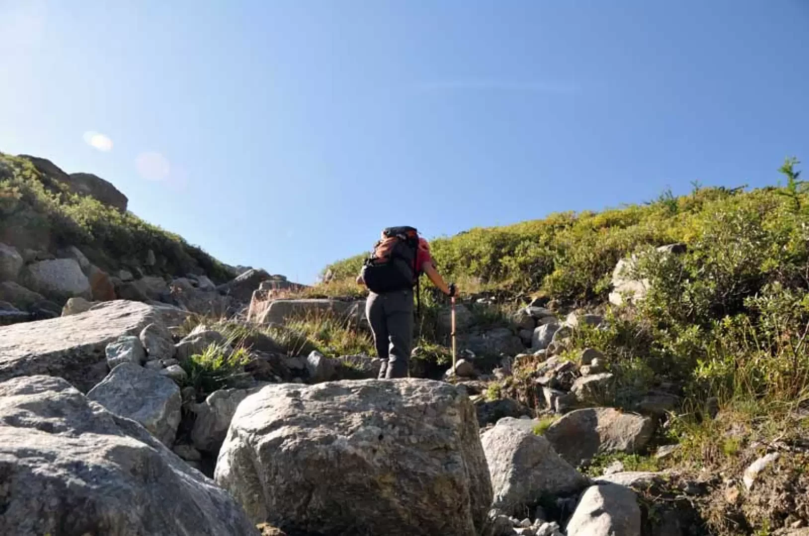
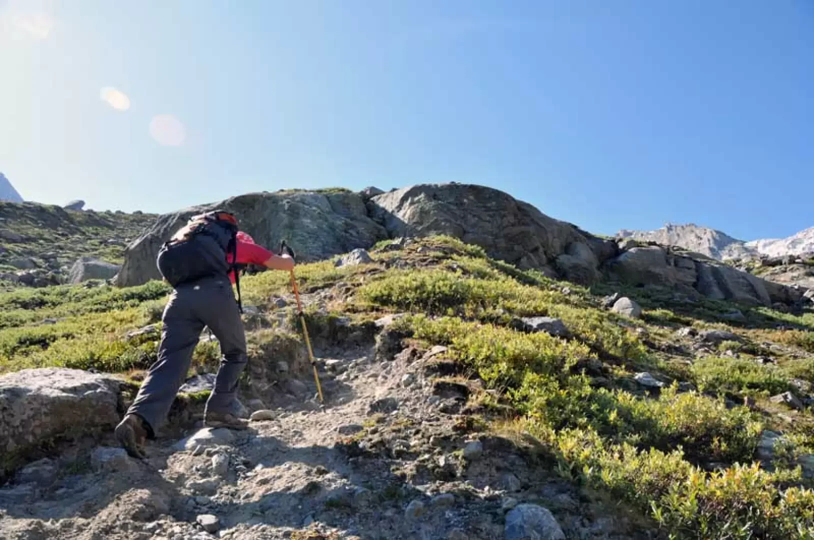
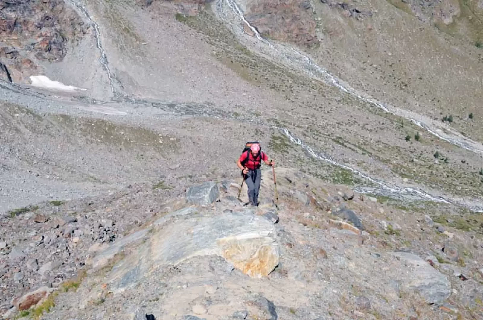
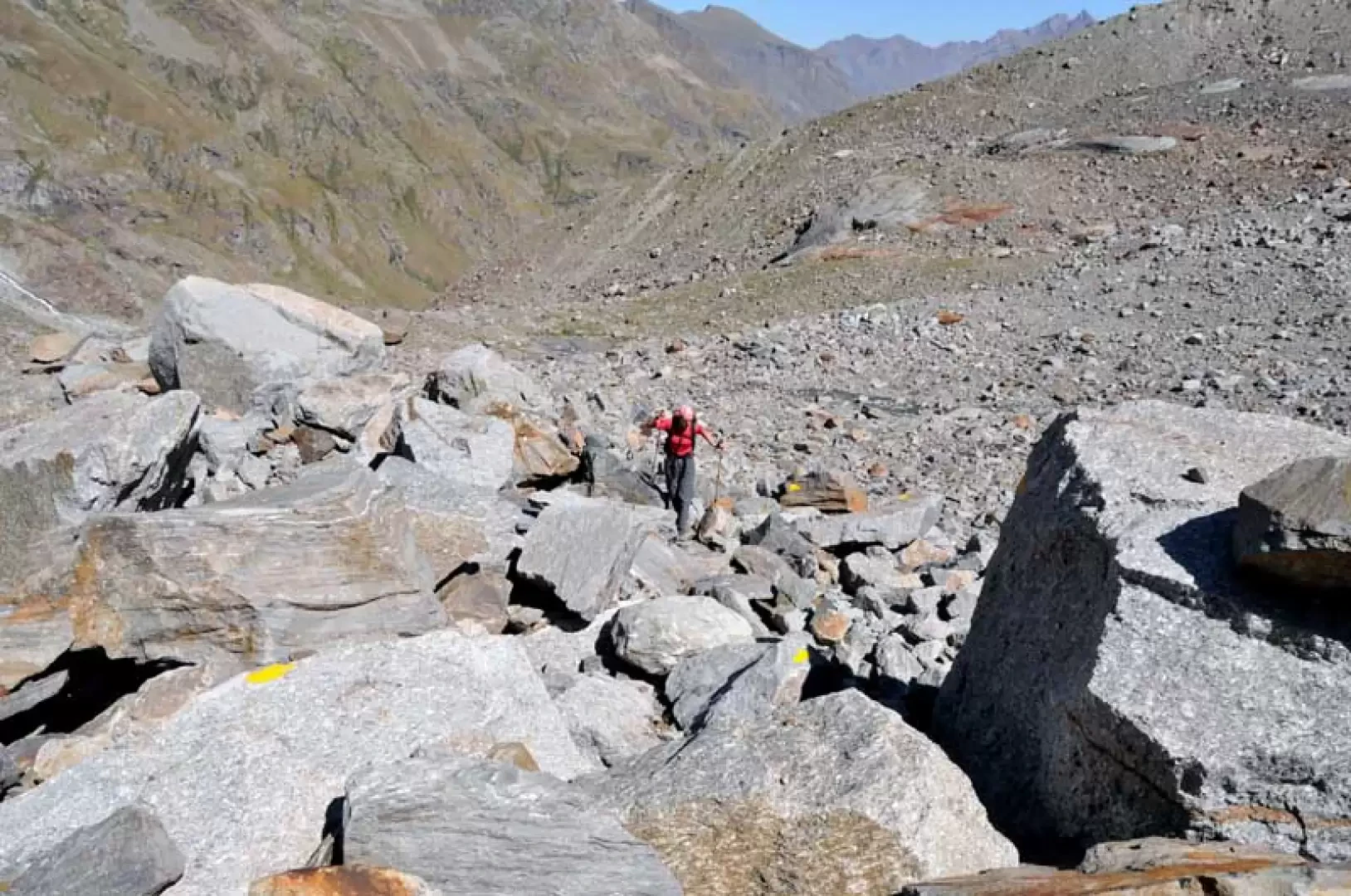
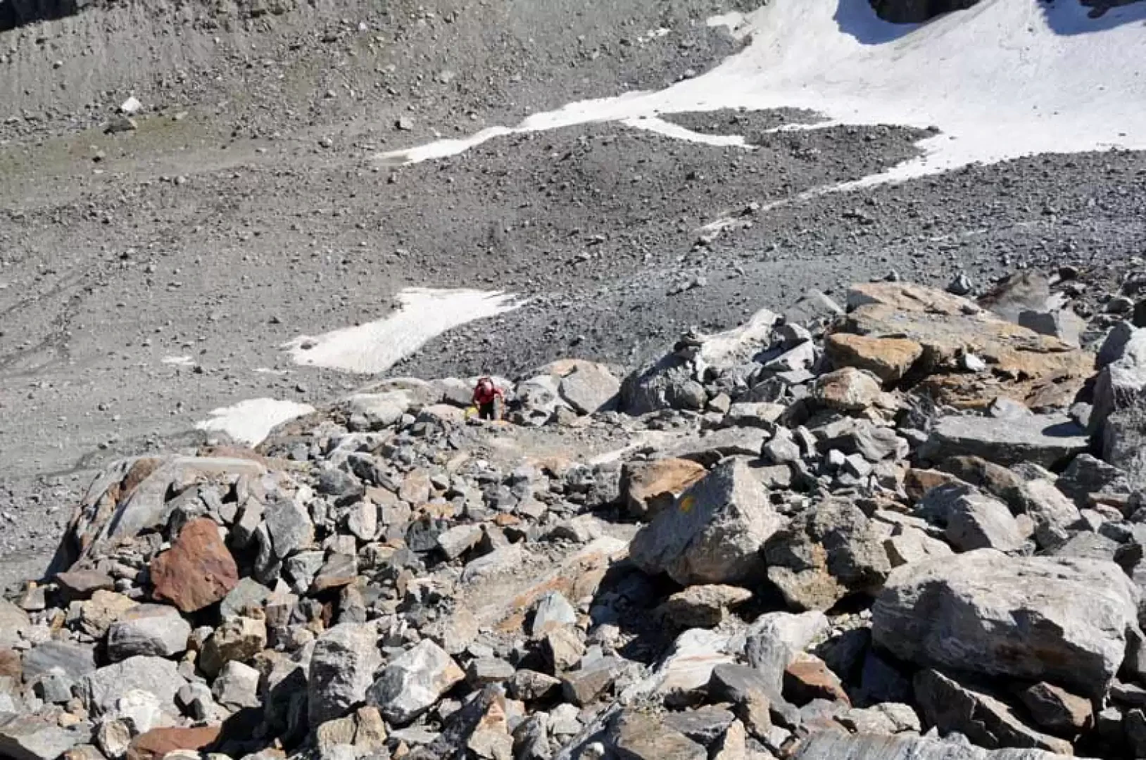
From the car park, head towards the bridge over the stream, which you leave to the right and continue in the direction of the gorge on the road that immediately becomes a dirt track and where you will find the starting points for the itinerary. Walk on level ground, passing in front of the campsite, and enter the forest along the old royal hunting road, passing the junction of a path that branches off to the left; as you progress along the valley, you always have in front of you the spectacle of the glaciers at its head and the high peaks that crown it. Almost immediately you pass the David hut (1713 m) and continuing further on you cross the Vermiana huts (1745 m), arriving after about a quarter of an hour to leave the dirt track and take the well-marked path that branches off to the left (1784 m). Continuing to walk almost level, go past a fork in the road from where the path for Money (1810 m) begins on the left and, having crossed a stream, you arrive at the recently built Erfaulets bridge (the old one has collapsed due to heavy winter snowfall) which crosses the Valnontey stream and continues on the opposite bank, skirting the watercourse alongside a high rocky rampart, passing a landslide of large boulders. After passing over a sturdy wooden footbridge, you arrive at a fork (2047 m) where, on the right, you leave the path that goes up to the Herbetetet cottages and the path continues on a slight incline among the low vegetation, arriving at yet another fork (2101 m) where you leave the track that leads to the Pol bivouac on the right; Immediately afterwards, once again cross the impetuous waters of the Valnontey stream on a solid bridge and, at an altitude of 2158 m, leave the trail to the left for the Money. Now the path, beginning to have a more accentuated slope, rises among low bushes, arriving at a gully of rocks that you cross directly arriving at the fork for the Martinotti bivouac (2226 m) where you take the path to the right that begins to climb up a grassy moraine whose slope increases noticeably as you proceed. When you come to a large rock, go around it on the level to the left to immediately take up the moraine, now steeper, which bends slightly to the left and becomes made of earth and stones. Climbing it again very laboriously, you come to a point (2571 m) where the track descends to the right towards a scree slope situated in a wide basin at the foot of the Gran Crou glacier and from where you can see the red outline of the bivouac above a rocky islet. After a few metres of difference in height, continue, well guided by the paint markers, crossing the scree slope and heading towards the promontory, climbing it again on steep rocks to arrive shortly at the summit where the bivouac is located.
.Galleria fotografica
We have been there

Edited by:
Massimo Martini
Bivacco Borghi
Report della gita
Informazioni generali
Condizioni via o sentiero:
Pericolo Oggettivo:
Tratti esposti:
Rischio valanghe:
Affollamento:
Condizioni meteo
Cielo:
Temperatura:
Condizioni neve:
Condizioni ghiacciaio:
Avvistamenti
Fauna: Rupicapra rupicapra, Capra ibex

Edited by:
vittorio beltrame
Bivacco Borghi
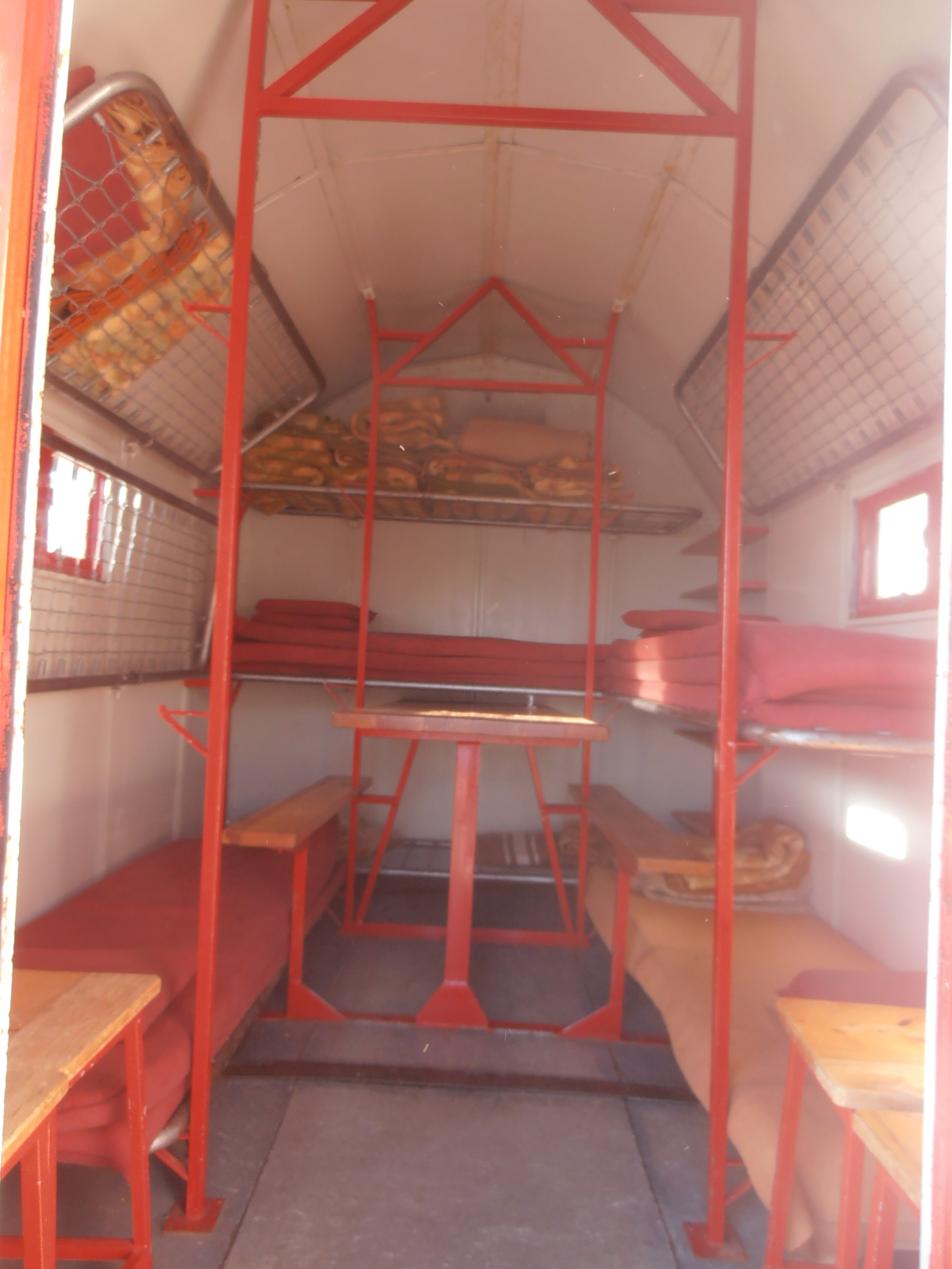
Bella gita anche se faticosa nel tratto sulla morena. Risalire tutta la valle di Cogne sino al parcheggio di Valnontey, dove termina la strada di pubblico accesso. Da qui bisogna risalire la vallata per un tratto su strada sterrata, poi al suo termine su un bel sentiero sempre all'ombra nel bosco. Si procede sempre con una leggera salita fino ad incontrare il primo bivio che porta al rifugio Vittorio Sella, ai casolari dell'Herbetet e al bivacco Leonessa. Lasciamo questo bivio proseguendo a sinistra. Proseguendo si arriva ad attraversare un robusto ponte e subito dopo si lascia a destra il sentiero per il bivacco Pol e Grappein. Proseguiamo sempre a sinistra fino a raggiungere l'inizio della morena, il tratto più faticoso dell'itinerario. Si incomincia a salire incontrando un altro bivio per il bivacco Money e il bivacco Martinotti. Si sale sul filo della morena fin quasi al termine dove il sentiero scende di lato in una conca, dove si vede l'isolotto roccioso su cui sorge il bivacco. Vi è ancora tanta neve, bisogna fare attenzione perchè in alcuni punti al di sotto scorre il fiume e potrebbe cedere la crosta superficiale. il panorama è stupendo, la nord della Becca di Gay, le seraccate del ghiacciaio della Tribolazione dove sullo sperone che le separa si intuisce l'itinerario di salita per i bivacchi Pol e Grappein fanno da contorno al bivacco, di fronte si intravede il tetto del bivacco Leonessa e in basso tutta la Valnontey sino a Cogne. Forse il nome Gran Paradiso non è stato dato a caso. Spettacolari i distacchi di ghiaccio dai seracchi. Discesa per lo stesso itinerario, molto utili i bastoncini. Abbiamo trovato il bivacco in disordine, coperte non piegate, parecchie bottiglie di plastica, la mattina dopo prima di ripartire abbiamo dato una sistemata al meglio e una bella ramazzata al pavimento. Tempo di salita dal parcheggio di Valnontey circa 4 ore e 30, giornata molto calda che sopratutto nel tratto su morena rende tutto più faticoso.Bella gita anche se faticosa nel tratto sulla morena. Risalire tutta la valle di Cogne sino al parcheggio di Valnontey, dove termina la strada di pubblico accesso. Da qui bisogna risalire la vallata per un tratto su strada sterrata, poi al suo termine su un bel sentiero sempre all'ombra nel bosco. Si procede sempre con una leggera salita fino ad incontrare il primo bivio che porta al rifugio Vittorio Sella, ai casolari dell'Herbetet e al bivacco Leonessa. Lasciamo questo bivio proseguendo a sinistra. Proseguendo si arriva ad attraversare un robusto ponte e subito dopo si lascia a destra il sentiero per il bivacco Pol e Grappein. Proseguiamo sempre a sinistra fino a raggiungere l'inizio della morena, il tratto più faticoso dell'itinerario. Si incomincia a salire incontrando un altro bivio per il bivacco Money e il bivacco Martinotti. Si sale sul filo della morena fin quasi al termine dove il sentiero scende di lato in una conca, dove si vede l'isolotto roccioso su cui sorge il bivacco. Vi è ancora tanta neve, bisogna fare attenzione perchè in alcuni punti al di sotto scorre il fiume e potrebbe cedere la crosta superficiale. il panorama è stupendo, la nord della Becca di Gay, le seraccate del ghiacciaio della Tribolazione dove sullo sperone che le separa si intuisce l'itinerario di salita per i bivacchi Pol e Grappein fanno da contorno al bivacco, di fronte si intravede il tetto del bivacco Leonessa e in basso tutta la Valnontey sino a Cogne. Forse il nome Gran Paradiso non è stato dato a caso. Spettacolari i distacchi di ghiaccio dai seracchi. Discesa per lo stesso itinerario, molto utili i bastoncini. Abbiamo trovato il bivacco in disordine, coperte non piegate, parecchie bottiglie di plastica, la mattina dopo prima di ripartire abbiamo dato una sistemata al meglio e una bella ramazzata al pavimento. Tempo di salita dal parcheggio di Valnontey circa 4 ore e 30, giornata molto calda che sopratutto nel tratto su morena rende tutto più faticoso.